Alert
Alerts
York Mallory - Hiking from Rivier d'Allemond
1 alert on this circuit
Visitor alert
As this route is potentially subject to severe damage due to major weather events and its viability may be uncertain, please enquire before embarking on it.
Description
This hike takes you up to the place where the Chief Marshal of the Allied air forces died in a mysterious air crash above Le River d'Allemond in June 1944.
TECHNICAL INFORMATION
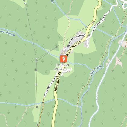
Departure point: Rivier d'Allemond (Musée du Bouquetin - Espace York MAllory)
Ascent: 747 m
Distance: 3.6 km one way
Level: moderate
ITINERARY
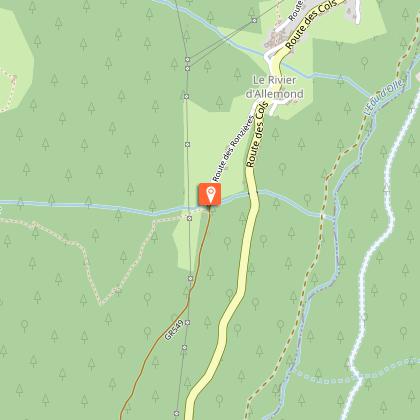
Parking is available in the parking lot opposite the Musée du Rivier.
From Le Rivier, walk from the church and follow the tarmac road to the Bruyant stream. From here, take the path that rises steeply through a forest of spruces and hardwoods to exit at 1700 m.
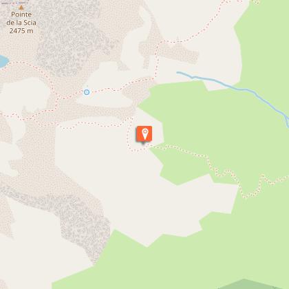
Continue due west through rhododendron and bilberry vegetation.
This leads to a well-marked, easy-to-follow path that climbs up several rocky steps.
This passage requires attention but is not technically difficult.
Pieces of the wreck are gradually revealed. Climb back up to the commemorative plaque (2100 m).
On the return journey (which takes the same route), a visit to the Maison du Bouquetin and the York Mallory space is a must.
Technical Information
Altimetric profile
Starting point
Steps
Date and time
- From 01/05/2026 to 31/10/2026
- From 01/05/2027 to 31/10/2027
Additional information
Updated by
Oisans Tourisme - 11/03/2026
www.bike-oisans.com
Report a problem
Environments
Mountain view
Mountain location
Favourites / Must-sees
Nearby is the Edelweiss farm, with its farm produce including cheeses, terrines and sausages.
Tips
After the walk, a visit to the Museum is a must.
Free and open weekends from 15/06 to 30/06 and from 1 to 15 September.
And daily in July and August from 11.15am to 1pm and from 2pm to 5.30pm.
Contact
Phone : 04 76 80 71 60
Email : info-allemond@oisans.com
Website : https://www.oisans.com/stations-et-villages/allemond/
Open period
From 01/05 to 31/10 daily.
Subject to favorable snow and weather conditions.
Type of land
Stone
Ground
Grit
Not suitable for strollers
Animals
Yes
Data author
