Alert
Alerts
Les 7 Laux - hike from Rivier d'Allemond
1 alert on this circuit
Visitor alert
As this route is potentially subject to severe damage due to major weather events and its viability may be uncertain, please enquire before embarking on it.


IGN cards


Description
This itinerary takes you through a succession of Isère's most famous lakes (Laux). At times, the slope is quite steep, but you'll be amply rewarded by the discovery of these beautiful mountain lakes and the various surrounding massifs.
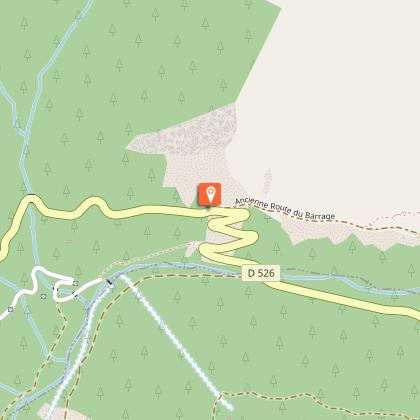
Shortly after Rivier d'Allemond, park on the old Col de la Croix de Fer road, which runs off to the left and ends in a cul de sac, in front of the huge landslide that forced its reconstruction on the opposite slope.
TECHNICAL INFORMATION:
Start: Le Rivier d'Allemond
Ascent: 904 m
Distance: 5.4 km
Level: difficult
ROUTE :
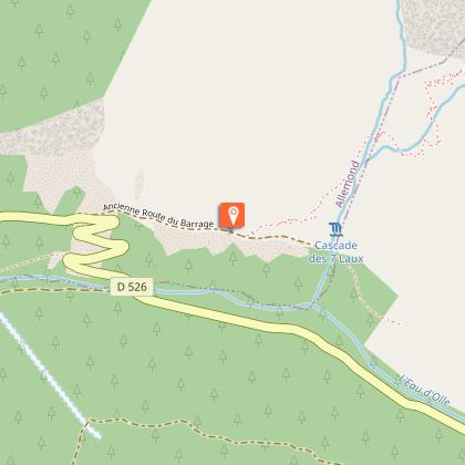
After Le Rivier, continue along the road for about 2 km to the junction of the old road (blocked) and the new road, which winds its way down to the valley floor. The trailhead is at this junction. The path crosses the valley side for around 1 km, then climbs steeply up the combe des 7 Laux.
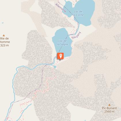
At the top of the plateau, the Lac de la Sagne comes into view. The succession of lakes leads from Oisans to Grésivaudan.
For the return journey, a variant is possible via the Col de la Vache, with a negative altitude gain of 1,200 m.
GOOD TO KNOW :
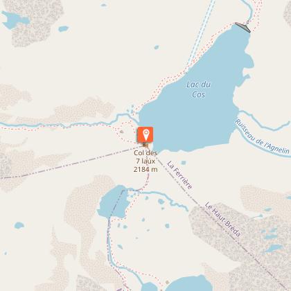
Ibex spot! This area is rich in chamois and ibex, a species reintroduced in 1983 by hunters and EDF when the Grand' Maison dam was built. The 7 Laux, as their name suggests, comprise 10 lakes: Lac de la Sagne, Lac de la Corne, Lac Jeplan, Lac Agnelin, Lac du Cos, Lac Blanc, Lac Cottepens, Lac Carré, Lac de la Motte and Lac Noir.
Following the lakes, you cross the Belledonne massif.
Technical Information
Altimetric profile
Starting point
Steps
Additional information
Updated by
Oisans Tourisme - 02/10/2025
www.bike-oisans.com
Report a problem
Environments
Mountain view
Mountain location
Close to GR footpath
Open period
From 01/05 to 31/10 daily.
Contact
Phone : 04 76 80 71 60
Email : info-allemond@oisans.com
Website : https://www.oisans.com/stations-et-villages/allemond/
Topo guides and map references
Topo guides references :
OBP map no. 2 (Oisans au Bout des Pieds): trail 205
Map references :
TOP 25 IGN 3335ET
Type of land
Rock
Stone
Ground
Tricky passages
The route is equipped in places with concrete steps and cables, which can be useful on the descent.
To be avoided on rainy days, as some sections are slippery.
Animals
Yes
Data author
