Alert
Alerts
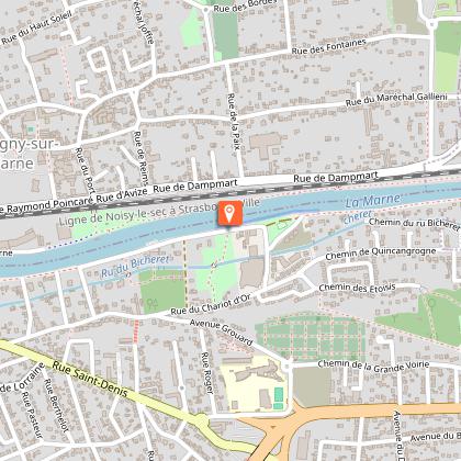
Running Route 16km "South of the Marne"

The Cirkwi brief
Wanderlust beckons along the picturesque Marne River with a 19km route that invites not only runners but adventurers of all sorts. Planned meticulously by the Office of Tourism of Marne and Gondoire, this trail encapsulates the essence of Guermantes, Bussy-Saint-Georges, and Lagny-sur-Marne in a single sweep. Prepare to lose yourself in the rich tapestry of natural and historic marvels as you traverse the banks of France's longest river. Offering more than just a physical challenge, this journey promises an immersive experience into the heart and soul of Marne and Gondoire.
Technical Route Overview
Covering a distance of 19km, with elevation ranging from 40m to a peak of 123m, this route presents a moderate challenge to enthusiasts. The estimated cumulative elevation gain is around 230m, offering a blend of flat terrains and gentle ascents. Crafted for both novice and seasoned runners, the well-thought-out path allows for a comprehensive engagement with the environment, while ensuring a physically rewarding session. Perfect for those seeking a blend of scenic beauty and physical exertion.
Seasonal Tips and Safety
Regardless of the season, this trail offers unique charms. In spring, the blossoming flora along the Marne's banks is a sight to behold, while autumn decorates the path with vibrant hues. Summer provides lush greenery, though hydration is key under the sun. Winter, coated in frost, offers a serene quietude, yet demands proper thermal gear. Safety-wise, always inform someone of your plans, carry a mobile phone, and wear reflective clothing if you're out at dusk. Remember, the weather can change quickly, so check forecasts before departing.
Heart of History and Culture
Embarking on this trail is a journey through time and culture. Guermantes, Bussy-Saint-Georges, and Lagny-sur-Marne are steeped in history, from ancient farms to medieval churches. The Marne River itself has been a lifeline for the region, influencing trade, agriculture, and lifestyle over the centuries. This route is not just a fitness path but a passage through areas that have shaped local culture and history, making it an enriching experience for both the body and the mind.
Local Weather Insights
The overall climate is temperate, with mild summers and cool winters, making any season ideal for visiting. However, for the most pleasant journey, the late spring to early autumn period is recommended. During these months, the weather balances warmth with comfortable cool breezes, offering the best conditions for outdoor activities. Nonetheless, always prepare for sudden changes in weather by carrying appropriate clothing and checking the local forecast regularly.
IGN cards


