Alert
Alerts
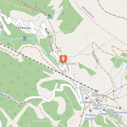
Hiking trail: from Lindarets Village to Brochaux Waterfall
IGN cards


Description
An easy hike from Les Lindarets, known for its goats and traditional architecture, to the magnificent Cascade des Brochaux.
The path winds through the woods and you are lulled by the soothing murmur of a pretty river.
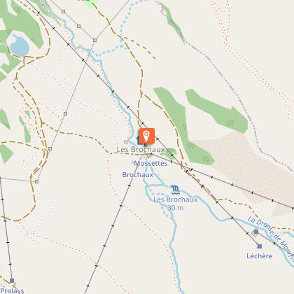
As you approach the Cascade des Brochaux, you can hear the gentle murmur of flowing water. The waterfall, a true natural gem, spills its waters into a natural pool. It's the ideal place for a relaxing break, a picnic in the heart of nature or simply to enjoy the comforting calm.
Technical Information
Altimetric profile
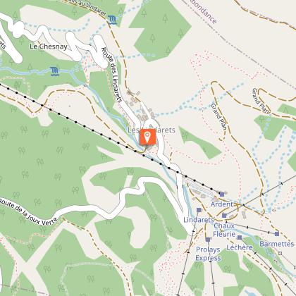
Starting point
Points of interest


Date and time
- From 01/05/2026 to 31/10/2026
Additional information
Open period
From 01/05 to 31/10 daily.
Accessible outside the snow season and subject to weather conditions. Check with the Tourist Office beforehand for current access conditions. Recommended season: spring - summer - autumn.
Free ski lift on presentation of the Multi Pass card.
Subject to favorable weather.
Updated by
Vallée d'Aulps Tourisme - 19/12/2025
www.valleedaulps.com
Report a problem
Environments
Mountain location
Waterfall view
Contact
Phone : 04 50 79 12 81
Email : info@valleedaulps.com
Website : https://www.valleedaulps.com
Facebook : https://www.facebook.com/valleedaulpstourisme
Type of land
Stone
Ground
Grit
Suitable for all terrain strollers
Location complements
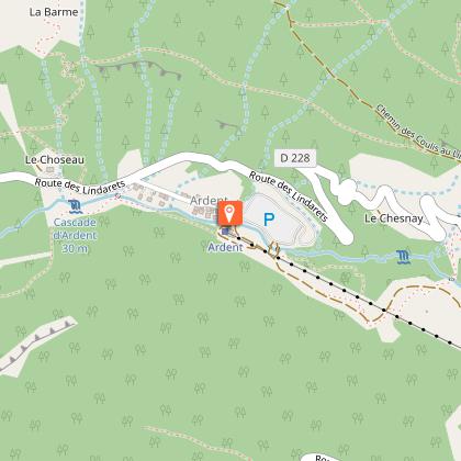
Start: footpath to the right of the Chaudron restaurant (footpath sign).
> Access by car from Cluses or Thonon: D902 then D228. Car park at the entrance to the village of Les Lindarets.
In July and August, traffic restrictions make it difficult to get to Les Lindarets by car, so it's best to either walk up the path from the Ardent car park (Ardent aux Lindarets), or take the Ardent cable car (you can then take the free little train to the village of Les Lindarets from the cable car arrival station).
Topo guides and map references
Map references :
Map: IGN TOP 25, 3528 ET, Morzine
Reception complements
- Choose your route according to your physical condition and the weather conditions.
- Follow the instructions for signposting.
- Take sufficient food and water with you. Mountain sports require a lot of energy.
Guidebook with maps/step-by-step
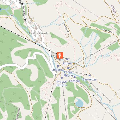
1/ From the village of Les Lindarets, follow the paved road towards the ski resort.
2/ Turn left onto Route des Lindarets, pass the upper station of the Ardent cable car and continue to the ‘Les Barnettes’ sign in front of the ‘Les Alpages’ restaurant.
3/ At Les Barnettes, take the path on the right above the restaurant ‘Les Alpages’ and follow the direction indicated by the signpost ‘Les Brochaux’. Follow the path below the Léchère chairlift, along the river. The path climbs gently but steadily, sometimes through the forest, sometimes through a clearing.
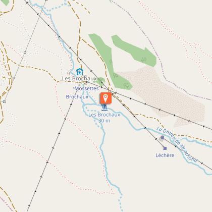
4/ Stay on the right side of the river until you reach the entrance to the forest to reach the village of Les Brochaux and then the waterfall.
5/ At Les Brochaux, cross the bridge to reach the waterfall, which is already in sight.
6/ Arrival at the Cascade des Brochaux.
Return via the same route.
Animals
Yes. Pets welcome, but there is a free-roaming herd of goats in the village of Les Lindarets.
