Alert
Alerts
Mont Veyrier hike
Description
Hike to one of the most famous lookouts on the lake and surrounding area. The loop takes you along a beautiful ridge route overlooking the famous limestone cliffs of Mont Veyrier, visible from Annecy.
On this walk, you leave behind the shores of Lake Annecy and its soothing atmosphere. The magnificent ridge trail to the summit is well worth the effort: it's a challenging and sporting climb.
Nevertheless, the shade of the pines and deciduous trees provides a pleasant coolness. These sometimes spread out to give a glimpse of the lake and its turquoise waters: a foretaste of the superb panoramas awaiting you at the summit. The ridge trail starts from the Col des Sauts: you follow the GRP Tour du lac d'Annecy. After a series of short climbs and descents, you'll come to Mont Veyrier, with its impressive sheer drop; Mont Baron, the highest point of the hike; and the old cable car, a vestige of the area's tourist popularity during the Belle Époque.
This is the most beautiful panorama of the loop, with a breathtaking view of the lake and the Bauges on one side, and the Aravis mountains and Mont Blanc on the other. Two orientation tables allow you to discover or rediscover the surrounding peaks.
The route continues down the Vallon des Contrebandiers, returning to the Annecy-le-Vieux marina via the heights of the village of Veyrier du Lac.
Technical Information
Altimetric profile
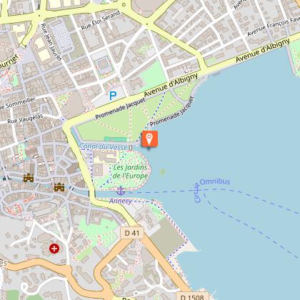
Starting point
Points of interest

Date and time
- From 15/05/2026 to 01/11/2026
- From 15/05/2027 to 01/11/2027
Additional information
Open period
From 15/05 to 01/11.
Subject to favorable snow and weather conditions.
Updated by
Conseil Départemental de la Haute-Savoie - 21/04/2026
hautesavoiemontblanc-tourisme.com/
Report a problem
Environments
Lakeside or by stretch of water
Mountain view
Mountain location
Contact
Phone : 04 50 45 00 33
Email : info@lac-annecy.com
Website : https://www.lac-annecy.com
Facebook : https://www.facebook.com/lacannecy.tourisme
Type of land
Stone
Ground
Grit
Not suitable for strollers
Location complements
Access (bus): The SIBRA bus network will drop you off close to the starting point.
- Lines n°26 and n°20 - Stop Petit Port Chavoires
- Route n°5 (Piscine-Patinoire / Glaisins) - Albigny stop
Access by car: From Annecy, take the D909 towards Veyrier-du-Lac on the east side of the lake, then Annecy. Park in the Petit Port public parking lot.
Topo guides and map references
Map references :
TOP 25 IGN 3431 OT - LAC D'ANNECY
Reception complements
Whatever your hike, remember to take cereal bars, sufficient water, sunglasses, sun cream, a small first aid kit, as well as clothes adapted to your outing according to the season and the weather forecast.
Guidebook with maps/step-by-step
1/ From the "Annecy (Parking du Petit Port)" post, head for "Mont Baron". Always follow this direction to the next villages. You will pass through "Bel Abri", "Le Bois Jettaz", "Sous Pré Vernet", "Pré Vernet (Parking)", "Col des Sauts (Panorama)", "Col des Sauts" then "Mont Veyrier".
2/ At "Mont Baron", head for Veyrier du Lac via Vallon des Contrebandiers. Continue following signs for "Veyrier du Lac", passing "Ancien Téléphérique", "Balcon des Contrebandiers", "Vallon des Contrebandiers", and "Grotte de la Cheminée".
3/ At the "Grotte de la Cheminée" post, continue the loop towards Veyrier du Lac via La Combe
4/ At "La Combe", follow signs for Talabar.
5/ From "Les Champs", follow "Petit Port". Continue in this direction, passing through "Le Biclop", "Talabar" and then "Sous Pré Vernet".
6/ Once you've returned to "Sous Pré Vernet", take the same route back to Petit Port (your starting point) as you did on the outward journey.
Animals
Yes. Pets allowed on leash only.
Data author
