Alert
Alerts
The Alpine Lakes hiking trail


Description
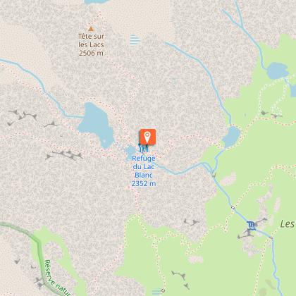
A long hike right in the middle of the Aiguilles Rouges Natural Reserve, giving fabulous panoramic views over Mont-Blanc. The main lakes comes one after the other: the Chéserys, Lac Blanc.
Access depending on meteorological conditions. For more information, contact the High Mountain Office of Chamonix: +33 (0)4 50 53 22 08.
Technical Information
Altimetric profile
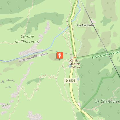
Starting point
Points of interest


Date and time
- From 15/06/2026 to 01/11/2026
- From 15/06/2027 to 01/11/2027
Additional information
Open period
From 15/06 to 01/11.
Subject to favorable snow and weather conditions.
Updated by
Conseil Départemental de la Haute-Savoie - 21/04/2026
hautesavoiemontblanc-tourisme.com/
Report a problem
Environments
Lakeside or by stretch of water
Lake view
Mountain view
Mountain location
Waterside
In a nature reserve
Contact
Phone : 04 50 53 00 24
Email : info@chamonix.com
Website : https://www.chamonix.com
Facebook : https://www.facebook.com/ChamonixMontBlanc/
Type of land
Stone
Not suitable for strollers
Location complements
Access (by car): From Chamonix Mont-Blanc, follow signs for Martigny - Swiss border.
Access (Bus): By bus, take the Tour-Col des Montets (line N°1). Stop at Montroc.
Access (Train): Access possible from Montroc train station (1360m / Chamonix - Martigny-CH line).
Topo guides and map references
Map references :
TOP 25 IGN 3630 OT
Reception complements
Whatever your hike, remember to take cereal bars, sufficient water, sunglasses, sun cream, a small first aid kit, as well as clothes adapted to your outing according to the season and the weather forecast.
Guidebook with maps/step-by-step
1/ From the Tré le Champ parking lot, follow the signs for "Lac Blanc 2h45". The path leads directly into the forest.
2/ Continue in the direction of "Lac Blanc" until you reach the Aiguillette d'Argentière.
3/ From the Aiguillette d'Argentière, continue on until you reach the Lacs des Chésery. Be careful, as the route includes ladders and a bit of a drop.
4/ You now reach the Lacs des Chésery. Continue along a final section with ladders to reach the Refuge du Lac Blanc and the lake.
5/ For the return journey, take the same route until you reach a large cairn with a sign. Follow the signs for "Col des Montets".
6/ Once you've reached the Col, take the left-hand path to the parking lot.
Animals
No. Animals prohibited in the Aiguilles Rouges Nature Reserve.
Data author
