Alert
Alerts
THE GOLFERS’ TRAIL

Description
At dawn, marmots...in the afternoon golfers. Start : La Rosière Centre. Easy.
LA ROSIERE’S GOLF COURSE
Creating a golf course in the mountains is not an easy task. Nevertheless, at the end of the 1980s there was a boom in the number of golf courses in the Haute Tarentaise area, giving two La Rosière locals the idea to bring this summertime activity to their resort. At first they tried playing around the Petit St Bernard pass, one of the few relatively flat spaces in the area. But the following spring they realised that the high altitude did not work in their favour - there was too much snow left over at the beginning of the summer season to allow them to make any more than a couple of holes. Finally, in 1988 they came to an agreement with the Montvalezan town council to create three holes in the area above the altiport. Seven years later the golf course had expanded to 9 holes. La Rosière’s golf course is open to everyone, from beginners to expert golfers, locals and tourists alike. Many Montvalezan locals have learnt to play here and have then gone on to play on other golf courses around the region and beyond, but they all come back to the Lièvre Blanc plateau as often as possible to enjoy the spectacular panorama. The course weaves between marmot holes and bilberry bushes, and is overlooked by the Mont Pourri and the Massif du Beaufortain, with an unhindered view over Bourg St Maurice and the Isère valley.
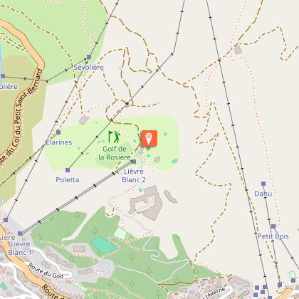
ITINERARY
Start your walk just up from the Tourist Office in La Rosière. Walk around the outside of the shopping centre towards Les Galopins Kids’ Club. Just after the Kids’ Club you will come to a crossroads. Go straight on, then after two bends go straight on again for around 400m, up the road leading through the forest. Turn off the road onto the slope on your right. When you reach the sign for the “Chemin des Vaches”, take the path leading up to the left and follow the trail around the top of the golf course. When you reach the road, turn left and walk past the golf clubhouse. Follow the road back towards the resort between the golf course and the altiport. When you reach the altiport hangar, turn off the road to the right and cross the fields towards the ski lifts. Follow the path under the drag lift down to the bottom of the slopes in La Rosière.
Technical Information
Altimetric profile
Starting point
Date and time
- From 01/07/2026 to 31/10/2026
Additional information
Environments
Mountain location
Updated by
La Rosière Tourisme - 28/10/2025
www.larosiere.net
Report a problem
Open period
From 07/01 to 10/31 : open daily.
Contact
Phone : 04 79 06 80 51
Email : info@larosiere.net
Animals
Yes
Data author
