Alert
Alerts
Tour de la Colle


Description
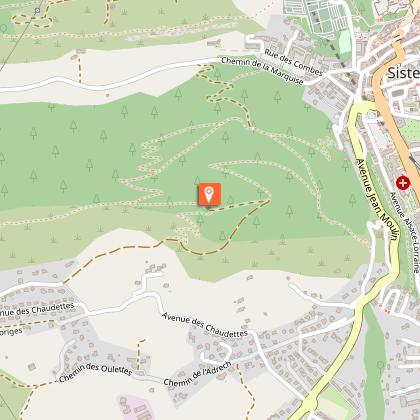
The Molard ridge offers many outlooks on the Sisteronais, the Jabron and the Buëch. The Ecrins and Dévoluy summits can be seen during your walk.
Take the departmental road D 53 on the left for about 50 meters. Go behind the police station and take the hairpin bends track going up into the Molard’s forest massif (GR markings). On your way, the botanical trail offers many interpretations.
At the aerial, leave the going down rocky track and completely bend on your right towards the ascending track. Overpass the hut and the viewpoint indicator and go straight on the path leading to the Molard.
At the Molard, go up the path towards the Rocher du Turc and the Mairie pass. Reach the ridge overlooked by oaks and box trees. Go on straight on the ridge and overpass the Rocher du Turc heading to the Mairie pass. A few meters further, the ridge transforms into a long descent through pine trees.
At the « Col de la Mairie » - the Mairie pass – signpost, turn right on a path leading to Sisteron (yellow markings). At the forest exit, cross the marls and turn right once the junction with the track reached.
At the junction with a tarred road – called Chemin de la Marquise – turn right and follow the road towards Sisteron.
Technical Information
Altimetric profile
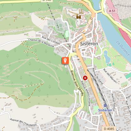
Starting point
Points of interest
Additional information
Public transport
Let’s limit our trips and use public transportation and carpooling: zou.maregionsud.fr
Advice
Avoid doing this hiking when wet or muddy weather. (The marl crossing is steep on the way back.) All along the hiking, explanatory boards about plants are located on the north and the south sides. Hikers will be able to distinguish the flora depending on the exposure. The Molard is also populated by a varied fauna from invertebrates to many birds and many other species. In this way, foxes can be seen much as hares and deer according to the season. But you must learn how to be patient, silent and observant. Visit of the Citadel of Sisteron advised.
Advised parking
Police station or town hall parking lot in Sisteron
Access
From Gap (50 km), follow the national road N 85 and take the motorway A 12 from La Saulce to Sisteron.
Arrival
Behind Sisteron’s police station.
Departure
Behind Sisteron’s police station.
Data author
