Alert
Alerts
Botanical Trail of the Molard


Description
This hike will make you discover the Massif of the Molard and its rich fauna and flora. Known as the « green lung » of Sisteron, the Molard has however lived hard time through centuries due to a lack of forestation.
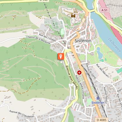
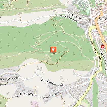
This hike begins just behind the police station (“gendarmerie”), not too far from the road sign « Montée du Molard ». Few meters after the beginning of the path, you’ll pass by a playground. Follow the path which will lead you to the botanical trail. The trail meanders up for about one kilometer (with a net climb? of 200 meters). All along the footpath, take time to watch and read the descriptive signs about the different tree species.
After 35 minutes walk, you’ll arrive to an intersection with a high communication antenna. Two options are possible : Or you continue to the « Plateau de Thor ». Or you could go on walking towards the orientation table.
After a 10 minutes walk, you’ll pass by the forest cabin and arrive to the Molard’s orientation table, which shows you the different surrounding summits. From this platform, you could admire a 360° panoramic view over the Sisteronais Valley, the villages of Laragne-Montéglin and Ribiers and also over the Durance Canal, which flows gently to the South. This promontory would be a perfect place for a picnic time with several tables and trashbins. After this break, continue your hike by following the trail. Along the path, panels will describe you the living creatures that you could meet during your hike and their place in the forest ecosystem.
After a few hundred meters, while the GR 6 continues on the mountain ridge of the Molard, take the footpath on your right at the signpost “Le Molard”.
Arriving to a small platform, you have two possibilities : you could go down by the forest track to the « Chemin de la Marquise » and reach the city center, after a 500 meters walk. The other way would be to walk back the trail to go back to your departure point.
Technical Information
Altimetric profile
Starting point
Points of interest
Additional information
Public transport
Let’s limit our trips and use public transportation and carpooling: zou.maregionsud.fr
Advice
All along the path, there are panels introducing the vegetation of the North and South sides of the mountain. The hikers would see the flora difference according to the sunset exposition. The Molard is also inhabited by a diverse fauna, from invertebrates to birds and many other species. So, you can observe foxes, hare, and deers according to seasons. Meanwhile you’ll have to be a patient and silent observer ! Continue your journey with a visit of the Citadel of Sisteron.
Advised parking
Place de la République Parking lot, Sisteron
Access
From Gap (50km), follow the N85, then take the A51 from La Saulce to Sisteron.
Arrival
Behind Police office, Sisteron
Departure
Behind Police office, Sisteron
Data author
