Alert
Alerts
Our ancestors’ ways


Description
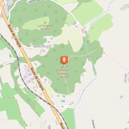
Follow in the footsteps of the homo "faber" who once inhabited the Ginestes. Archaeological investigation has revealed terracotta vases, bronze razors, engraved bracelets ... On the way back, it is interesting to stroll through the alleys of the old town.
Take the D 1075 towards Laragne. Continue through to the railway crossing and take the second road on the left (rue Flamenche); then follow the road C 174, on the left, which winds up. Pass the reservoir and the campsite (a shortcut cuts a hairpin bend). Continue straight on to the farm. At the fork, take the left path.
500 m further, go down to the right (post "Sous la petite Gineste") in the wood, cross the ravine and go up to the top of the Petite Gineste (776 m). You have there the opportunity to observe the remains of a double dry stone wall, the only remains of an entrenched Ligurian camp. Go down west, then south. Take the footbridge and walk along the small canal to the left.
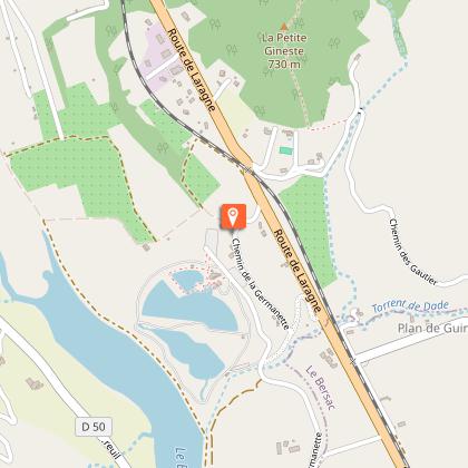
Take the stony path on the right and join the D 1075, level with the railway crossing (be careful).
Cross and follow the D 1075 on the left for 200 m.
Walk down the 1st path on the right, bypass the leisure center on the right (by turning left, possibility of swimming at the leisure center; 1.6 km round trip). Follow the track which winds its way through the orchards and reaches the bank of the Buëch River. Follow it to the right to quietly return to the starting point.
Technical Information
Altimetric profile
Starting point
Points of interest
Additional information
Public transport
Let’s limit our trips and use public transportation and carpooling: zou.maregionsud.fr
Advice
Possibility of swimming at the Germanette leisure center (1.6 km round trip from the trail).
Advised parking
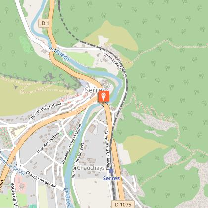
Tourist office parking lot in Serres
Access
From Laragne-Montéglin (17 km), follow the D 1075 north-west to Serres.
Arrival
Tourist office, (Buëch Bridge, right bank), Serres
Departure
Tourist office, (Buëch Bridge, right bank), Serres
Data author
