Alert
Alerts
Le Pied du Mulet


Description
A pleasant hike through pastures and unspoiled nature. With its hoof-like shape, the Pied du Mulet—the highest peak in the Méouge region—offers panoramic views of the Ecrins, the Luberon, and Mont Ventoux.
From the parking lot, head up to the village along the trail on the right.
Cross Eourres via the main street on the left, passing by the “village sign” and the fountain... As you leave the village, leave the small road and take the path on the right (“Col de Verdun, Saint-Vincent”). Go around the last house via a narrow path on the left. Continue above it along a path that is often steep and rocky. At a water intake, climb left for about 1 km along a path between the rocks. After a short descent, cross a ford, go around a large rock, and climb left along a steady, gently sloping path to the “Col de Verdun” signpost (1,316 m).
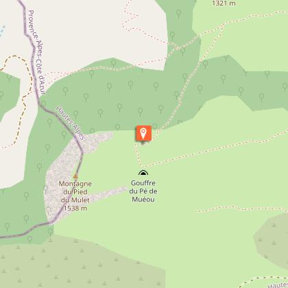
Climb to the right toward the Pied du Mulet along a faint trail through broom and then boxwood. The trail turns right and, after a steep rocky section, emerges above the cliff onto a sloping grassy area. Cross it and head due west (follow the markers closely) to reach a small hillock (1,459 m; panoramic view of Lure and the Jabron Valley). Follow the ridge, cross a first small valley (cairn), continue straight up (follow the markers closely) to reach, on the ridge (1,495 m), a second small valley (post). You can reach the summit of the Pied du Mulet mountain (1,537 m) by crossing the pasture.
Head down the valley to the right to find a better-marked trail in the shade of the beech trees. Follow the edge of the forest for about 500 m, then take a narrow path to the left that leads to a trail a little further down (1,272 m).
Head left and continue on flat ground for about 700 m, then cross the pasture to the right (be sure to follow the trail markers).
Descend two successive hills, then turn right (sign for “Eourres”) and continue downhill through this eroded valley (crossing a few scree slopes). After a flat section, descend to the left and cross the Gros Ruisseau (which is far from impressive in summer). Follow it for about 100 meters, then head back up to the village via the trail on the right along the edge of the gardens. Follow the ascent route back to the parking lot.
Technical Information
Altimetric profile
Starting point
Additional information
Public transport
Let’s limit travel and consider using public transportation or carpooling: zou.maregionsud.fr Taxidrome Service (book your taxi at least 24 hours in advance): 08 10 26 26 07
Advice
Visit Eourres, a village known for its community initiatives, which promotes a lifestyle in harmony with its environment: eourres.fr/ A fairly strenuous but accessible hike with a few steeper sections. The descent from Pied du Mulet is quite rugged and requires constant attention (the trail markers are hard to see).
Advised parking
Parking lot located below the village (cars are not allowed in the village), Eourres
Access
From Laragne-Montéglin (23 km), follow the D 942 and D 24 southwest to Eourres.
Arrival
Parking lot, Eourres
Departure
Parking lot, Eourres
Data author
