Alert
Alerts
Crêtes de Chamouse (N°1)


Description
This route along the border between the Drôme and Hautes-Alpes departments offers panoramic views from the ridge! The vast expanse of mountain pastures is breathtaking. Not to be missed!
At the signpost, take the trail that descends to the left. At the intersection near the ruins, turn right and pass the “DFCI – Tussie Reserve” sign. At the next fork, turn right, follow the winding trail uphill, and cross a small stream. Continue up the trail until you reach a meadow. Continue straight ahead to reach a small path that runs alongside a fence. Follow this path and, further on, at the intersection, go straight ahead; you can also climb directly up to the ridge on the right. Cross a small dry stream and then a marl area. Then climb to the Col de Tous les Vents, preceded by a short stretch through the forest.
At the pass, continue along the trail to the right, then cross a national forest by taking a wide trail to the right.
At the next intersection, turn right and head uphill to reach the Col d’Izon (1,343 m).
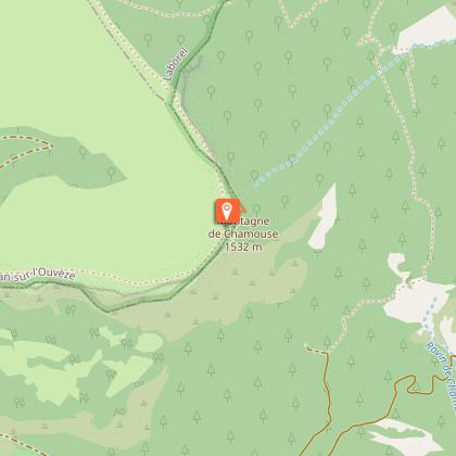
At the Col d’Izon, turn right toward “Montagne de Chamouse – 1.5 km.” Follow the markers leading to the vast Chamouse mountain pastures. Cross the pastures to the summit of Chamouse (1,532 m). There is no longer a trail on this section of the route; follow the cairns. Descend 900 m along the ridge.
At the signpost, turn right onto a small path descending into the forest (“La Tussie” - 1,430 m) toward “Laborel.” Cross the beech forest and continue descending. Further down, the path becomes a trail. Follow this trail back to the starting point.
Technical Information
Altimetric profile
Starting point
Additional information
Public transport
Let’s limit travel and consider using public transportation or carpooling: zou.maregionsud.fr On-demand transportation (book at least 24 hours in advance): 08 10 26 26 07
Advised parking
Parking lot on Route de Perty (signpost), Laborel
Access
From Laragne (26 km), take the D 1075 road, then the D 30 (Eyguians junction) towards Orpierre, then the D 65 to Laborel and continue towards the Col de Perty. At a hairpin curve on the right, turn left onto the track (signposted ‘DFCI – réserve de la Tussie’).
Arrival
Route de Perty - Piste de la Tussie, Laborel
Departure
Route de Perty - Piste de la Tussie, Laborel
Data author
