Alert
Alerts
Lac de Soi
Description
Perched at an altitude of 2,247 m, the strenuous hike is well worth the glorious surprise that awaits you here!
Plan de Soi (route des Rives) - Signal de Soi - Lac de Soi - Cascade de Frassenaye - Plan de Soi
The aquamarine jewel in the Dents du Midi’s crown, this limpid alpine lake is set in an improbable labyrinth of stone artwork, as if surrounded by the ruins of a fairytale civilization.
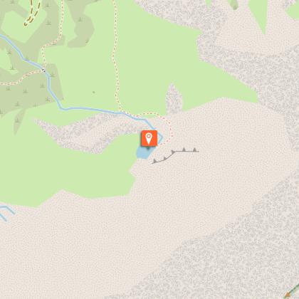
Departure point on the Les Rives road at point 1206.
Follow the steep trail from Plan de Soi ascending NE in zigzags. At the pass, a path follows the Soi Ridge. After the pastures, the path crosses two rivers and a small ravine to reach the lake. Descend by the same path; if you have the energy, you can take a short detour from the pass, following a trail to the Signal de Soi viewpoint
A little history:
In 1989, Pierre-Marie Cherix brought his brother to visit this magnificent site. The two brothers fell hopelessly in love with the magic of this place, with its sparkling alpine lake and abundant local stone scattered throughout the plateau. The first dry-stone cairn they built triggered a lifelong passion which has resulted in an intricate stone landscape which showcases the raw, mineral beauty of the Alps.
In the Soi area, in August, September and October, sheepdogs and sheep are in the area. Dogs are not allowed.
Bivouac and camping prohibited.
Technical Information
Altimetric profile
Starting point
Points of interest

Additional information
Updated by
Région Dents du Midi SA - 03/07/2026
www.regiondentsdumidi.ch
Report a problem
Contact
Phone : +41 24 479 05 50
Email : valdilliez@rddm.ch
Website : https://www.regiondentsdumidi.ch/fr/region/valdilliez
Facebook : https://facebook.com/regiondentsdumidi
Twitter : https://twitter.com/regdentsdumidi
Data author
