Alert
Alerts
Les Essarts walking trail
Description
A refreshing trail amidst forest and stream, with a historical backdrop. Take a delightful stroll to explore the charming old hamlet of Charmaix, interspersed with informative signposts that are well worth reading.
Put the miles behind you at your leisure, and don't forget to regularly stop and drink. Conquer 380 metres of elevation as you plunge deep into the wonders and sounds of the forest. Take a break at Notre-Dame du Charmaix to add a spiritual touch to your snacktime. It looks like it's hanging off the cliff. Pause inside this surprising building to admire the decorations, paintings, and the striking black and white statue of a mother and child.
Technical Information
Altimetric profile
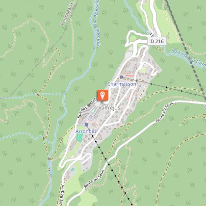
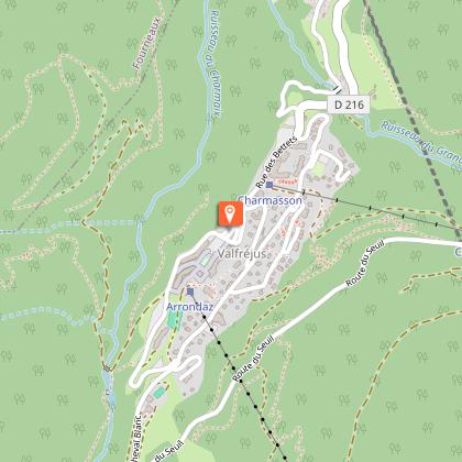
Starting point
Points of interest


Date and time
- From 15/05/2026 to 15/10/2026
- From 15/05/2027 to 15/10/2027
Additional information
Open period
From 15/05 to 15/10 daily.
Subject to favorable weather.
Updated by
Communauté de communes Haute Maurienne Vanoise - 20/04/2026
www.cchautemaurienne.com
Report a problem
Environments
Riverside
Mountain view
Forest location
Waterside
Mountain location
Bus stop < 500 m
Close to a public transportation
Contact
Phone : 04 79 05 99 06
Email : info@hautemaurienne.com
Website :
https://www.haute-maurienne-vanoise.com
http://www.cchautemaurienne.com/jy-vais-en
Type of land
Stone
Ground
Grit
Not suitable for strollers
Location complements
To get there by bus: Line 1 - Tourist Office stop.
By car: Park in the parking lot opposite the Valfréjus tourist office.
Topo guides and map references
Topo guides references :
Map and booklet "Haute Maurienne Vanoise. 120 walks and hikes - 36 trail routes. For all levels" (sold for €12 in Tourist Offices)
Map references :
Map IGN 3535OT - Névache Mont Thabor
Reception complements
The duration of hiking trails is calculated using reference paces: 300 m/h ascent, 500 m/h descent and 4 km/h on the flat.
As hazards may occur at any time on the routes, the GPX tracks provided are not contractual. They are given for information only. Riders use them at their own risk, depending on their level of technological proficiency and their understanding of the terrain.
Guidebook with maps/step-by-step
To guide you in the field, consult the "step-by-step" directional diagram provided in pdf.
Animals
Yes. Out of respect for wildlife, please keep your dog on a lead.
Data author
