Alert
Alerts
Hiking: from hamlet to village


Description
Discover the picturesque hamlets and villages of the Vallée d'Aulps: a hike where nature and culture intermingle along the way. Our cultural heritage, surrounded by a remarkable natural environment, will hold no secrets for you!
Along the way, discover the villages of Seytroux, Le Biot, La Baume, the Jotty dam and the superb Mont Ouzon.
A trail partly in the forest, where you can enjoy the natural coolness of summer.
This route crosses the main road twice. At these points, you should be very careful before crossing and walk faster as you do not have the priority. The route is not suitable for pushchairs and we do not recommend it for young children.
Technical Information
Altimetric profile
Starting point
Points of interest


Date and time
- From 23/03/2026 to 20/11/2026
Additional information
Open period
From 05/01 to 10/31 : open daily.
Updated by
Vallée d'Aulps Tourisme - 15/09/2025
www.valleedaulps.com
Report a problem
Environments
Lakeside or by stretch of water
Mountain view
Waterside
Mountain location
Contact
Phone : 04 50 79 65 09
Email : info@valleedaulps.com
Website : https://www.valleedaulps.com
Facebook : https://www.facebook.com/valleedaulpstourisme
Type of land
Ground
Grit
Location complements
Departure from Pont de la Tassonnière in Seytroux
> access by car from Thonon via the D902, then Pont de la Tassonnière 300 m to the right after the Tines tunnel
> access by shuttle bus: Balad'Aulps Bus stop (valley shuttle) in front of the Saint Jean d'Aulps cemetery, then reach the Tassonnière bridge by the roadside (approx. 300 m).
Topo guides and map references
Map references :
Map: IGN Top 25, 3528 ET, Morzine
Reception complements
- Choose your route according to your physical condition and the weather conditions.
- Follow the instructions for signposting.
- Don't set off too late in the afternoon, to make sure you're back before dark.
- Take sufficient food and water with you. Mountain sports require a lot of energy.
Guidebook with maps/step-by-step
1/ Departure from Tassonnière bridge
2/ Head towards Seytroux and a few metres after the bridge, fork right along the path that runs alongside the Dranse.
3/ Pass through the hamlets of Les Girauds and Ombre. When you have a choice between the main road (limited to 50 mph) and the small road to the right, take the small road to the right.
4/ At the end of the chemin des Rossets, you will come to a stop sign. Continue straight ahead on a small track to the left of a pond, then turn left at the next crossroads towards the hamlet of Le Sey.
5/ Once in the hamlet of Le Sey, follow the signpost to Urine. You can choose between a road that goes down to the right between the houses and a road that goes up to the left. Take the one on the right (the one on the left takes you to a private property). At the end of the Sey, the road becomes woodland.
7/ At the "Urine" and "Le Crêt" signs, keep going in the direction of "Le Biot". Along the way, you'll see signs for "Chez les Geydets", then further down "Couvaloup". In this case, we're looking to cross the Pont de Couvaloup, in the direction of Le Biot.
8/ Once you've reached the Pont de Couvaloup, you'll need to cross it and then cross the main road. WARNING: crossing the road is dangerous. Cars sometimes arrive very quickly. Make sure you cross at the right moment (check that you don't hear any engine noise and that there are no cars to your left or right), and hurry along at a brisk pace.
9/ Once in Le Biot, cross the village to pick up the path at the end of the hamlet of Les Cottets. Follow the sign to Bas-Thex. Cross the D32 to the south.
10/ Climb back up the path, then descend, and after a few hairpin bends, the Saint-Guérin oratory comes into view.
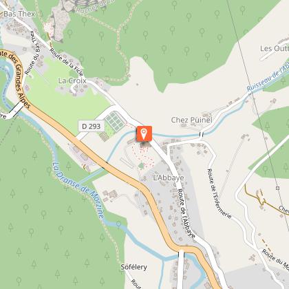
11/ Continue on to the hamlet of Bas Thex and reach the Tassonnière bridge. Alternatively, make a detour towards the Abbey to get a closer look, then retrace your steps.
Animals
Yes
