Alert
Alerts
Hiking: Crêtes de Seytroux grand tour
Description
Whether you're an experienced hiker or simply looking for a nature break, the Crêtes de Seytroux grand tour promises an unforgettable adventure in the heart of the Vallée d'Aulps' mountain pastures and forests.
Don't miss out on the generous flora along the way, and you may be lucky enough to spot roe deer or chamois at the bend in the path.
A 360° panorama awaits you from the top of the Pointe de la Gay, with breathtaking view of Mont Blanc, the Roc d'Enfer and all the surrounding peaks.
Technical Information
Altimetric profile
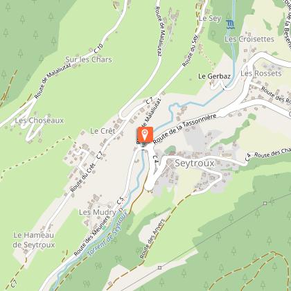
Starting point
Date and time
- From 01/05/2026 to 31/10/2026
- From 01/05/2027 to 31/10/2027
Additional information
Contact
Phone : 04 50 79 65 09
Email : info@valleedaulps.com
Website : https://www.valleedaulps.com
Facebook : https://www.facebook.com/valleedaulpstourisme
Open period
From 05/01 to 10/31 : open daily.
Updated by
Vallée d'Aulps Tourisme - 03/04/2026
www.valleedaulps.com
Report a problem
Environments
Mountain view
Panoramic view
Mountain location
Type of land
Stone
Ground
Grit
Not suitable for strollers
Topo guides and map references
Map references :
Map: IGN Top 25, 3528 ET, Morzine
Location complements
Departure from the Culées parking lot in Seytroux
Access by car from Thonon or Cluses via the D902 then the D294 or D193 towards the village of Seytroux.
- At the roundabout in front of the Kern restaurant, turn right over the bridge, then right again towards Les Crêts and Malahutaz.
- Climb for several kilometres until you reach the forest track.
- Continue along the track to the Les Culées car park.
Reception complements
- Choose your route according to your physical condition and the weather conditions.
- Follow the instructions for signposting.
- Don't set off too late in the afternoon, to make sure you're back before dark.
- Take sufficient food and water with you. Mountain sports require a lot of energy.
Tricky passages
Some tricky sections equipped with a chain in the forest on the way back to Les Frasses.
Guidebook with maps/step-by-step
> From the "Les Culées" parking lot,
1/ Take the forest track towards the Col de la Balme.
2/ At "Mouilles dernier", turn right towards Col de la Balme.
3/ At Richefond, continue to follow the signs for Col de Balme on the right.
4/ At Col de la Balme, take the left-hand path towards Col de la Lanche.
5/ Below Pointe de la Balme, turn left towards Pointe de la Balme and Col de la Lanche.
6/ At Pointe de la Balme, continue straight ahead on the trail.
7/ At Col de la Lanche, continue straight on towards Pointe de la Gay.
8/ Below the Pointe de la Gay, follow the signs for the Pointe de la Gay, on the left.
9/ At the Pointe de la Gay, follow the ridge to the Col des Chavannes.
10/ At Col des Chavannes, take the left-hand path towards "Les Chavannes".
11/ At Les Chavannes, follow the signs for "Dessus la Lanche".
12/ At "Dessus la Lanche", continue on the right towards "Vers les Crottes".
13/ At "Vers les Crottes", follow signs for "Les Culées".
14/ At "Les Frasses", take the carriage road on the right towards "Les Culées".
15/ At "Mouilles dernier", continue towards "Les Culées" parking lot.
Animals
Yes. Dogs must be kept on a leash due to the presence of herds
