Alert
Alerts
Guéritolles walk
Description
An easy hike from the heights of Montriond along a forest trail to the hamlet of Guéritolles, from where you can enjoy superb panoramic views over the villages of Montriond, Morzine and Essert-Romand.
Along the way, you'll see traditional granaries and alpine chalets, and enjoy magnificent views of the surrounding villages and peaks.
Technical Information
Altimetric profile
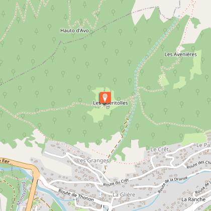
Starting point
Steps
Date and time
- From 01/04/2026 to 31/10/2026
- From 01/04/2027 to 31/10/2027
Additional information
Open period
From 01/04 to 31/10 daily.
Accessible outside the snow season and subject to weather conditions. Check with the Tourist Office beforehand for current access conditions. Recommended season: spring - summer - autumn.
Subject to favorable weather.
Updated by
Vallée d'Aulps Tourisme - 27/06/2026
www.valleedaulps.com
Report a problem
Environments
Cycling itinerary less than 1 km away
Mountain view
Mountain location
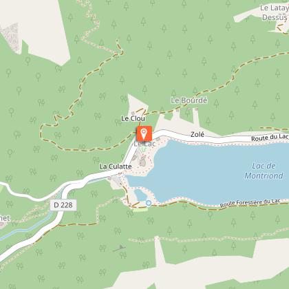
Lake -5km away
Village -2 km away
Contact
Phone : 04 50 79 12 81
Email : info@valleedaulps.com
Website : https://www.valleedaulps.com
Facebook : https://www.facebook.com/valleedaulpstourisme
Type of land
Stone
Ground
Grit
Suitable for all terrain strollers
Location complements
Free parking in the hamlet of Les Granges, about ten metres before the start of the path.
> access by shuttle bus: stop of the free shuttle bus line Mbis at the hamlet of Les Granges
> Access by car from Cluses or Thonon: D902 to the Plagnettes roundabout, then take the route du Crêt to the hamlet of Les Granges.
Topo guides and map references
Map references :
Map: IGN Top 25, 3528 ET, Morzine
Reception complements
- Choose your route according to your physical condition and the weather conditions.
- Follow the instructions for signposting.
- Don't set off too late in the afternoon, to make sure you're back before dark.
- Take sufficient food and water with you. Mountain sports require a lot of energy.
Guidebook with maps/step-by-step
> Start the path above the Granges parking lot (located at the street "sous les buissons").
1/ Climb up to the edge of the forest, then turn right to go up into the forest, at the "Plan du Tronc" sign.
2/ After a few hairpin bends, the path levels out and you'll see Les Guéritolles. Remember to close the cow pens after you've gone through.
3/ Cross Les Guéritolles. After a while, we come to a path that twists and turns downhill. We don't take it, but continue straight ahead. We pass the barrier and then start our descent on the right, on a forest path. We continue downhill until we reach the hamlet of Le Pas.
4/ Follow the road downhill for a while. You'll pass through the hamlet of Le Crêt. Then take the road that rises to the right at the "Route des Granges du Bas" sign.
Animals
Yes. Dogs must be kept on a leash due to the presence of herds
