Alert
Alerts
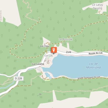
Walking trail: from the center of Montriond to the lake

Description
A pleasant walk accessible to all, from the centre of the village to the superb Lac de Montriond.
A woodland trail where you can enjoy the natural coolness of summer. Take the time to marvel and recharge your batteries in this green paradise!
Technical Information
Altimetric profile
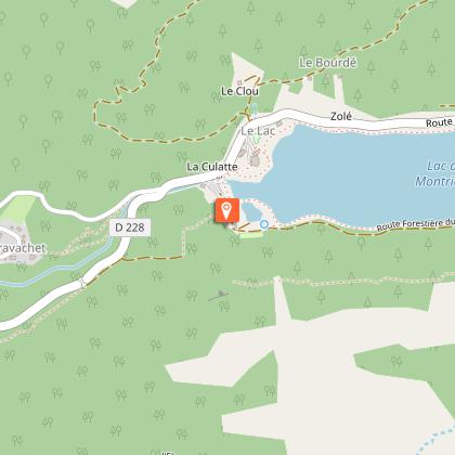
Starting point
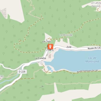
Points of interest


Date and time
- From 01/04/2026 to 31/10/2026
- From 01/04/2027 to 31/10/2027
Additional information
Open period
From 05/01 to 10/15 : open daily.
Updated by
Vallée d'Aulps Tourisme - 02/04/2026
www.valleedaulps.com
Report a problem
Environments
Lakeside or by stretch of water
Mountain view
Lake view
Mountain location
Close to a public transportation
Near shuttle stop
Contact
Phone : 04 50 79 65 09
Email : info@valleedaulps.com
Website : https://www.valleedaulps.com
Facebook : https://www.facebook.com/valleedaulpstourisme
Type of land
Stone
Ground
Grit
Location complements
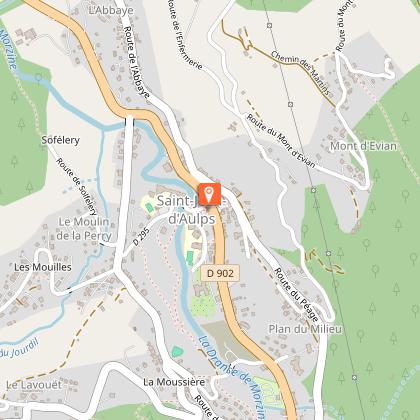
Departure point: car park at Place de la Mairie, in the commune of Montriond.
> access by shuttle bus: stop for the free Morzine/Montriond shuttle bus and the Balad'Aulps Bus (valley shuttle bus) in front of the town hall.
> access by car from Cluses or Thonon: D902 then D229
Topo guides and map references
Map references :
Carte : IGN TOP 25, 3528 ET, Morzine
Reception complements
- Choose your route according to your physical condition and the weather conditions.
- Follow the instructions for signposting.
- Don't set off too late in the afternoon, to make sure you're back before dark.
- Take sufficient food and water with you. Mountain sports require a lot of energy.
Guidebook with maps/step-by-step
> Start behind Montriond town hall.
1/ Walk along the road until you see the footpath sign on the right.
2/ Go up into the forest, keep left at the fork in the road and follow the path.
3/ At the parking area, turn right as far as Lac de Montriond.
To return :
1/ Cross the car park to the road, go down for about 100 metres to the fork, take the road on the right.
2/ Walk 50 metres down the road to the footpath entrance on your left.
3/ Follow the path to the road (hamlet of Lavanchy).
4/ Continue for 30 metres and take the path on the left along the river.
5/ Continue as far as the Chebourins bridge, cross the bridge and go back up the left bank.
6/ Cross the hamlet of La Ranche to the roundabout, then continue straight on to the village of Montriond.
Animals
Yes
