Alert
Alerts
Walking trail: discovering Saint-Jean-d'Aulps
Description
Explore St Jean d'Aulps village, with its little lanes and tracks, it's an ideal peaceful walk for the family. On the way there's the church, Aulps abbey and the St Guérin oratory to see.
Technical Information
Altimetric profile
Starting point
Steps


Points of interest

Additional information
Open period
Throughout the year : open daily.
Updated by
Vallée d'Aulps Tourisme - 08/04/2026
www.valleedaulps.com
Report a problem
Environments
Village centre
Close to a public transportation
Near shuttle stop
Contact
Phone : 04 50 79 65 09
Email : info@valleedaulps.com
Website : https://www.valleedaulps.com
Facebook : https://www.facebook.com/valleedaulpstourisme
Type of land
Stone
Ground
Grit
Suitable for all terrain strollers
Location complements
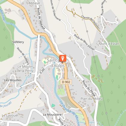
Departure from the Vallée d'Aulps tourist office in Saint Jean d'Aulps.
> access by car from Thonon or Cluses via the D902
> access by shuttle bus: Balad'Aulps Bus stop (valley shuttle bus) in front of the reception office
Topo guides and map references
Map references :
Map: IGN TOP 25, 3528 ET, Morzine
Reception complements
- Choose your route according to your physical condition and the weather conditions.
- Follow the instructions for signposting.
- Don't set off too late in the afternoon, to make sure you're back before dark.
- Take sufficient food and water with you. Mountain sports require a lot of energy
Guidebook with maps/step-by-step
> Departure: Tourist Office of Saint Jean d'Aulps.
1/ Follow the RD 902 towards Morzine.
2/ At the Jaff VTT shop, turn right, cross the bridge over the Dranse, then turn right and follow the road alongside the ranch. At the next junction, keep left.
3/ When you reach the road turn left. Then turn right at the junction with the Route de la Moussière, then left towards Seytroux at the sign for Le moulin de la Perry.
4/ Follow the Route du Sofélery, then the path towards Seytroux as far as the Tassionnière bridge. Go under the bridge, then turn left towards Le Bas-Thex.
5/ Back on the road, turn left and cross the Tassonière bridge towards Le Bas-Thex.
6/ After the bridge, turn left by the lay-by until you reach the bins, cross the Route des Grandes Alpes and head uphill towards Le Bas-Thex.
7/ At Bas-Thex, turn right towards the Abbey. During the Abbey’s opening hours, you can walk down to the car park and take the path leading to the site entrance, then exit onto the Route de l’Abbaye.
8/ Head to the village centre via the Route de l’Abbaye.
Animals
Yes
