Alert
Alerts
The balcony of the Marne
Description
4h walk including the Saint-Antoine de Carnetin church, the aqueduct of the Dhuis and the banks of the Marne.
Technical Information
Altimetric profile
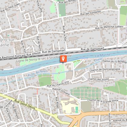
Starting point
Points of interest


Additional information
Environments
Riverside
Waterside
Updated by
Office de Tourisme de Marne et Gondoire - 11/03/2026
www.marneetgondoire-tourisme.fr
Report a problem
Open period
All year round daily.
Contact
Phone : 01 64 02 15 15
Email : officedetourisme@marneetgondoire.fr
Website : https://www.marneetgondoire-tourisme.fr
Data author

The Cirkwi brief
Embark on a semi-urban, semi-natural stroll through the diverse landscapes of Marne et Gondoire, brought to you by the local tourism office. This journey seamlessly blends urban exploration with the tranquility of nature. From the bustling streets near the Gare to the serene paths by the Marne river, every step is an invitation to discover the quaint village of Carnetin, the historical aqueduct de la Dhuis, and the hidden trails of Thorigny-sur-Marne. It's more than just a walk; it's a narrative woven through the heart of Marne et Gondoire, promising picturesque views and unexpected encounters, such as a closeness with nature in the company of ostriches.
Paths, Peaks, and Points: A Technical Overview
Spanning a distance of 13.2 km, this route is marked by significant topographical variety, with elevations ranging from 40 meters to a maximum of 125 meters above sea level. The cumulative positive elevation change is 420 meters, showcasing both the route's challenge and its rewarding vistas. Delivered in a compact form, this route, designed by the Office of Tourism of Marne et Gondoire, demands moderate physical fitness, primarily due to its undulating nature and the potential for muddy paths during wet conditions. This overview underscores the physical demands and scenic rewards of the journey.
Essential Seasonal Tips and Safety
Different seasons offer unique experiences along this route. Spring and autumn present mild temperatures and vibrant landscapes, ideal for those looking to capture the essence of Marne et Gondoire. However, paths can be slippery after rain; sturdy footwear is essential. Summer offers long, lush days perfect for extended exploration, though hydration is key under the sun. In winter, the scenery transforms, but prepare for potentially muddy sections and shorter daylight hours. Always respect traffic laws when crossing roads, especially the busy D418, and consider carrying a map for navigation through the less marked sections.
A Glimpse into Marne et Gondoire's Rich Heritage
Marne et Gondoire, nestled within the department of Seine-et-Marne, occupies a special place in French history and culture. The region's story is deeply intertwined with that of the Marne river, a lifeline during various epochs. The aqueduct de la Dhuis, a marvel from the Second Empire era, showcases the ingenuity of past engineers. This route not only offers a physical journey but also a deep dive into the historical layers that have shaped this terrain, from its rural beginnings to its current status as a natural sanctuary within the bustling Ile-de-France region.
Weather Insights for Optimal Visitation
The region enjoys a temperate climate, with distinct seasons offering varying experiences. Spring and autumn are particularly pleasant, with moderate temperatures and reduced crowds. This period is perfect for enjoying the route's natural and historical features without the extremes of summer heat or winter chill. Summer brings warmer days, ideal for extended daylight exploration, but ensure to protect against the sun. Winter, while cold, offers a unique, tranquil beauty, though some paths may be more challenging. The optimal visitation times are late spring to early autumn, balancing weather conditions and the route's natural charm.