To see around
See more
Open
Close
Show
Show
Show
Show
Show
Show
Show
Show
Show
Show
Show

Oups... It would appear that Cirkwi does not have permission to use your location.

Description
Map
Steps
Points of interest
Ratings and reviews
See around

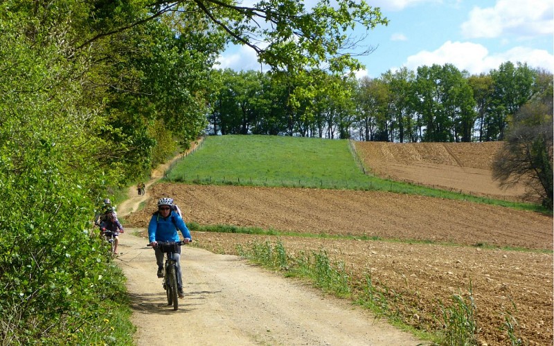
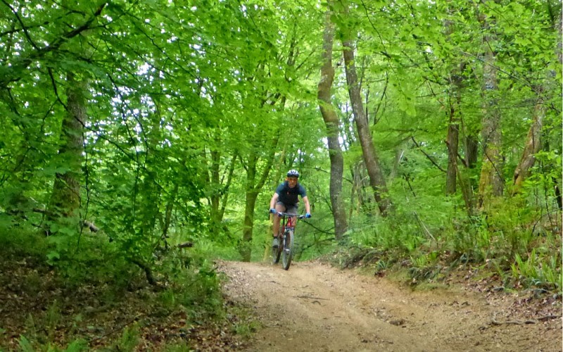
VTT 6 Tour du Pays de Nay

Chemin Henri IV basse def
Ancolies basse def
Au fond la Plaine de Nay depuis Chemin Henri IV basse def
Descente basse def
Lac de Sargaillouse basse def
Maison au dessus de Montaut basse def
Passage sur Chemin Henri IV basse def
VTT6 Balisage basse def
Vue depuis Saint Vincent basse def
Vue sur Saint Vincent basse def

Description

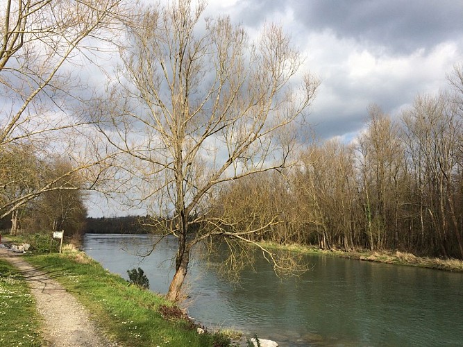
A very beautiful and interesting circuit via side roads. Although with no great technical difficulties, this circuit is aimed at sporty people because of its length and its climb. A key element of Nay’s lowland landscape, the canals have existed since the Middle Ages. They were used for irrigation and to power mills and hammers. Their role was essential in the development of industry in Nay during the 19th century. The water intake of Coarraze in the right bank gives rise to the canal of the Lagoin, which supplies the stream of the same name and the lowland canal. Left bank upstream of the Claracq bridge, the Grau canal flows into the Escourre and creates the Gaou canal. From these canals and streams flow a number of small irrigation channels.

Technical informations

This circuit was updated on: 15/04/2024
72 km
max. 499 m
min. 206 m
878 m

Altimetric profile

Starting point

64800 MONTAUT
Lat : 43.129844636Lng : -0.20072538

Steps

image du object
1

From Montaut to Beuste

Leave from behind the church of Montaut and go on a small road along the town hall. Cross the level-crossing. At the fountain turn left on the road, Cami des Bereyes. At the stop sign turn right then left towards Saint-Vincent. On the ascent turn left. On a bend turn right and go down. To the right go up on a path in a wood of beech trees right before a farm. At the top on a track turn left. After 300m ( 984ft.) go down to the right. Go to the right of the lake of Sargaillouse and turn right on the track. At the intersection turn right then follow the path to the left. On the road turn left for 400m ( 1312ft.). In the ascent, turn right on the path Chemin du bois. Go up the valley of the Lagoin. At the top continue to go up on the road to the left. Turn left on the path Chemin Henri IV. At the stop sign turn left and enter Saint-Vincent. Turn right in front of the church, follow the path Chemin Henri IV for 7km (4.35mi.). Turn left and leave the path Chemin Henri IV. Go down in the forest. Turn right in the descent until the path becomes steep-sided. Go to a small path that has a steep descent. Cross the stream and turn left. Cross the road and go straight ahead. After an ascent, turn left. On the road turn left then right. Stay on the main track. Once back on the road turn right at Beuste.

- Office de Tourisme Communautaire du Pays de Nay -
Consulter
image du object
2

From Beuste to Assat.

After 600m ( 1968.5ft.) turn right on the track and 50m ( 164ft.) further turn left up a very steep and technical small path. In the ascent turn left then right. Once back on the road go up to the right. Turn left on the path Chemin Henri IV for 7km ( 4.35mi.). Turn left, leave the path Chemin Henri IV. Back on the road turn left, go down, turn left along the ring road. At the crossroads turn right, go into a tunnel. Turn left, cross a bridge and turn left. At the crossroads turn right and once again to the right. After a level-crossing, ride 200m ( 656ft.) and turn left on a small road between houses. Go to another small road in the village of Assat. At the traffic light go straight ahead then turn right on the street Rue de la mairie. At the stop sign turn right and at the next one turn right. Turn right and pass by the castle. At the end of the park wall, turn left. Turn left then right and to the left once again. At the stop sign, turn right. At the roundabout turn right, cross the bridge of Assat.

- Office de Tourisme Communautaire du Pays de Nay -
Consulter
image du object
3

From Assat to Notre Dame de Piétat

Turn left, small path then turn right to cross a small dam then a footbridge. At the crossroads turn right on a track. At the crossroads in Baliros, turn right, cross a bridge and then turn left. Turn right on the track that goes up. Then turn left. At an old quarry follow the track in the middle. Pass by the fountain of Broucas. Go to the corner on the right on a kind of ridge in the forest and go down. Back on the road turn left and go up. At the top of the hill, turn left on the road Chemin de la Viossalaise. Stay on the path of the ridge continuing straight ahead. At the crossroads take the road D724 towards Notre-Dame-de-Piétat. Pass by the sanctuary.

- Office de Tourisme Communautaire du Pays de Nay -
Consulter
image du object
4

From Notre Dame de Piétat to Arros de Nay.

After the sanctuary, turn left and go down. After a small wood, turn right. Pass by a housing estate and enter Saint-Abit. Turn right on the road Chemin de Larroundade. At the crossroads, Rue de Cardède, turn right towards the church and the castle crossing the road D37. In front of the castle of Arros turn left. Cross the road and continue straight ahead. Pass by the “bascule” (weighing machine) and then turn right and after 100m ( 328ft.) go up to the left into the housing estate Moun de Rey.

- Office de Tourisme Communautaire du Pays de Nay -
Consulter
image du object
5

From Arros de Nay to Nay.

In the housing estate Moun de Rey, at the end of the track take a path to the right. 1km ( 0.62mi.) further turn left twice. Go down for 1km ( 0.62mi.). At the crossroads with a cross, go up to the left then go down. The view of Nay is very beautiful. In Nay, continue straight ahead. Cross the road D936 and continue straight ahead. In front of the fire station turn right along the Gave. Cross the Claracq bridge to the left. At the roundabout turn right. Reach the riverbank of the Gave. Turn left in front of the former mill (la Minoterie), then turn right. Go straight ahead in the no-through road (dead end).

- Office de Tourisme Communautaire du Pays de Nay -
Consulter
image du object
6

From Nay to Montaut.

Turn left towards Coarraze then right. After 200m ( 656ft.), turn left then right, in front of the secondary school. At the stop sign, turn right then left. Cross the railway bridge and turn right. At the roundabout straight on. Pass by the church of Coarraze and turn right the bridge and the road Rue de la textile. Turn left on the road Rue des Pyrénées. At the stop sign turn right on the street Rue de l’Ermitage. Turn left on the road Rue du martinet. At the sports hall, turn left then turn right twice. Turn left on the cycle path toward Lestelle-Bétharram. Cross the road D35 and ride for 3km ( 1.86mi.). Turn left, the crossroads with a Cross in Lestelle-Bétharram, then turn right then left, go down on a path. Turn right, at the riverbank of the Gave and go along for 1km ( 0.62mi.). Go up steps to rejoin the road, cross the bridge of the sanctuaries and turn immediately to the left. Follow a path along a field. Cross a small bridge and go up to the left on the road Rue Blanquine. Turn right then left to come back to the start.

- Office de Tourisme Communautaire du Pays de Nay -
Consulter

Additional information

Balisage

Yellow
panneaux VTT6 avec le nom "Tour du Pays de Nay"

Typologie de l'itinéraire

Loop

Thèmes

Natural

Contact

Fixed telephone : +33 5 59 13 94 99
Office de Tourisme Communautaire du Pays de Nay
Web site (URL) : www.tourisme-bearn-paysdenay.com
Office de Tourisme Communautaire du Pays de Nay

Ratings and reviews

To see around
See more
Open
Close
Show
Show
Show
Show
Show
Show
Show
Show
Show
Show
Show