Alert
Alerts
Roche Olvéra - Hiking trail

Description
This hike takes you to some excellent lookout points and mountain pastures.
To activate geolocation, click on the map icon.
Technical Information
Altimetric profile
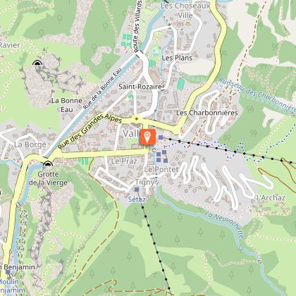
Starting point
Points of interest


Additional information
Tips
Please note: this itinerary includes a passage with a footbridge which is removed during the winter, making the hike inaccessible during this season. The footbridge is reinstalled at the end of June. Please contact the Tourist Office to confirm whether the footbridge is currently installed.
- Please check weather conditions before setting off.
- This hike takes place in summer when there is no more snow.
- Inform someone of your itinerary, as communication may be limited.
- It's best to leave in the morning, so as not to be surprised by the dark, and let someone know if you're going alone.
- The routes you take are your own responsibility.
- Choose an itinerary suited to your physical and technical ability. If in doubt, don't hesitate to contact mountain professionals.
- Make sure you're properly equipped for safe hiking and weather conditions. There are a few things you can do to make your experience safer and more enjoyable. Walking poles improve balance in the event of icy crampons, and regular hydration is essential.
Carry a water bottle and snacks to keep your energy up. Protect yourself from the sun with sunscreen and sunglasses. Don't forget binoculars to add a touch of observation to your adventure.
Updated by
Office de Tourisme de Valloire - 04/06/2026
www.valloire.net/
Report a problem
Environments
Mountain view
Panoramic view
Mountain location
Open period
From 01/06 to 31/10 daily.
Contact
Phone : 04 79 59 03 96
Email : info@valloire.fr
Website : https://www.valloire.net/
Topo guides and map references
Map references :
Map of Valloire hiking and mountain biking trails, on sale at the tourist office.
IGN map 3435ET VALLOIRE - Aiguilles d'Arves / Col du Galibier is on sale in Valloire shops.
Type of land
Rock
Stone
Ground
Not suitable for strollers
Reception complements
To keep the mountains a pleasure, choose an activity suited to your level of experience and physical ability. Check the weather and seek advice from qualified professionals, and tell someone about your itinerary. Set off with the right equipment: good shoes and walking poles. In your rucksack, carry a water bottle and snacks to keep your energy levels up, a survival blanket or warm clothing. Protect yourself from the sun with sunscreen and sunglasses. Don't forget binoculars to add a touch of observation to your adventure.
Guidebook with maps/step-by-step
Departure point: les granges du Galibier.
1/ cross the road once to join the path leading up to the summit.
2/ cross the road again to continue your ascent. The path to the summit is almost non-existent, so follow the grassy slope.
3/ At the summit, enjoy the majestic view and turn around.
Animals
Yes. Pets must be kept on a leash.
Data author
