Alert
Alerts
Balcon des Balais - Hiking trail
1 alert on this circuit
Alerte visiteurs
Itinéraire traversant des zones de pâturage : la présence de chiens de protection (patous) est possible en été. Adoptez les bons réflexes en approchant des troupeaux.


Description
This hike offers lovely views over the valley, and lets you discover life in the mountain pastures. You'll discover the different hamlets of Valloire. You'll pass over a Himalayan footbridge! Finally, keep your eyes peeled for marmots.
Discover one of Valloire's must-do hikes, a panoramic loop that plunges you into the heart of its authentic hamlets. Along the way, marvel at spectacular views of the surrounding peaks, with the majestic Grand Galibier in the background.
From the very first steps, the trail gently guides you around the Saint-Pierre rock, before leading you to the charming 19thᵉ century chapel. You'll then continue along the Valloirette, in a pleasant shady forest conducive to coolness and contemplation.
The highlight of this hike? Its superb balcony trail, offering a unique immersion into the heart of the Balais alpine chalets and landscapes open to the whole valley.
To round things off in style, the playful descent winds through the fir trees before taking you over a Himalayan footbridge, adding a touch of adventure to this unforgettable escapade.
Technical Information
Altimetric profile
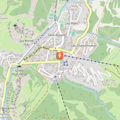
Starting point
Points of interest


Date and time
- From 01/05/2026 to 01/11/2026
- From 01/05/2027 to 01/11/2027
Additional information
Tips
- Find out about weather conditions before you leave.
- This hike takes place in summer when there is no more snow.
- Inform someone of your itinerary, as communication may be limited.
- It's best to leave in the morning, so as not to be surprised by the dark, and let someone know if you're going alone.
- The routes you take are your own responsibility.
- Choose an itinerary suited to your physical and technical ability. If in doubt, don't hesitate to contact mountain professionals.
- Make sure you're properly equipped for safe hiking and weather conditions.
There are a few things you can do to make your hiking experience safer and more enjoyable. Walking poles (even on the road) improve balance, and regular hydration is essential.
Carry a water bottle and snacks to keep your energy up. Protect yourself from the sun with sunscreen and sunglasses. Don't forget binoculars to add a touch of observation to your adventure.
Finally, check weather conditions and avalanche risks before you set off. Inform someone of your itinerary, as communication may be limited. These small adjustments will help you make the most of your getaway.
Updated by
Office de Tourisme de Valloire - 18/03/2026
www.valloire.net/
Report a problem
Environments
Mountain view
Mountain location
Open period
From 01/05 to 01/11 daily.
Subject to snow conditions.
Contact
Phone : 04 79 59 03 96
Email : info@valloire.fr
Website : https://www.valloire.net/
Topo guides and map references
Map references :
Map of Valloire hiking and mountain biking trails, on sale at the tourist office.
IGN map 3435ET VALLOIRE - Aiguilles d'Arves / Col du Galibier is on sale in Valloire shops.
Type of land
Rock
Stone
Ground
Not suitable for strollers
Reception complements
To keep the mountains a pleasure, choose an activity suited to your level of experience and physical ability. Check the weather and seek advice from qualified professionals, and tell someone about your itinerary. Set off with the right equipment: good shoes and walking poles. In your rucksack, carry a water bottle and snacks to keep your energy levels up, a survival blanket or warm clothing. Protect yourself from the sun with sunscreen and sunglasses. Don't forget binoculars to add a touch of observation to your adventure.
Guidebook with maps/step-by-step
1/ Go back down towards the "rond point de la vache", take the path behind Carrefour Montagne towards the Saint Pierre chapel.
2/ After the chapel, you'll come to a dirt track. Go left for 100m, then take the yellow signposted path on your right.
3/ Follow the signs for "Les Verneys" for 1.5km to the bridge.
4/ Cross the bridge and take the road opposite to the left of "La Boulange".
5/ Follow the road up to the intersection, turn right and then, 10 m further on, take the wide track on the left.
6/ Continue on the track between the houses as far as the footbridge.
7/ Turn left onto a narrow path and continue as far as Chalets de Beaujournal, then Les Balais.
8/ At the "Les Balais" sign, turn right on a balcony path to the concrete slab.
9/ Take the path on the right which descends (steeply) following the signs for "Le Serroz".
10/ Before reaching the dwellings, take the path signposted "Le Pont du Diable".
11/ Cross the footbridge, turn left and follow signs for "La Borgé".
12/ Join the carriage track which descends on the right to the starting point.
Animals
Yes. Pets must be kept on a leash.
Data author
