Nant Trouble walk
Description
Take the whole family on a pleasant walk through a variety of environments and landscapes, around a bucolic stream and close to the Grandes Médiévales d'Andilly and Grand Parc.
See the church in Saint-Symphorien (carved wooden panels from the Carthusian monastery in Pomier), the vicarage in Andilly (exhibitions, carillon, gardens) and the waterfalls on the Nant Trouble. In Charly, you'll see the 15th-century chapel. Find out about the Park of Legends and the site of the Grand Mediaeval Festival.
Technical informations
3 km
|
min. 99999 m
80 m
80 m
| |||
Altimetric profile
Starting point
Steps
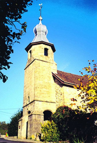
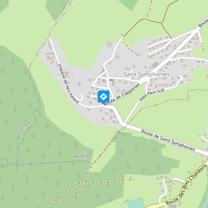
Eglise de Saint-Symphorien
Charmante église dotée de panneaux de bois sculpté. La cure propose des expositions et un jardin d'ornement au son du carillon.
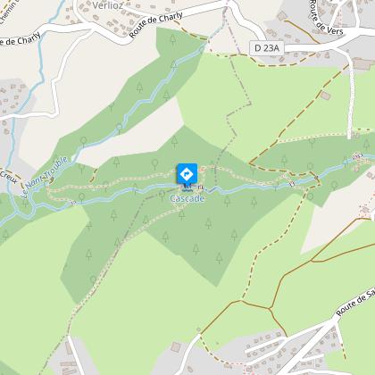
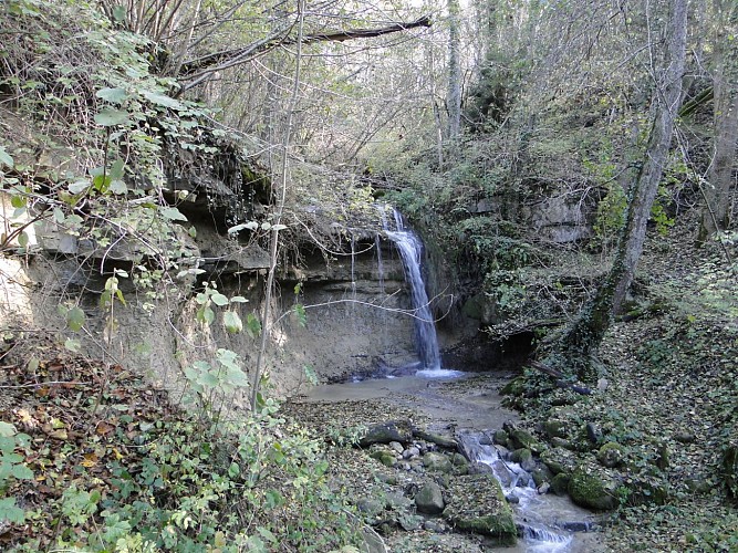
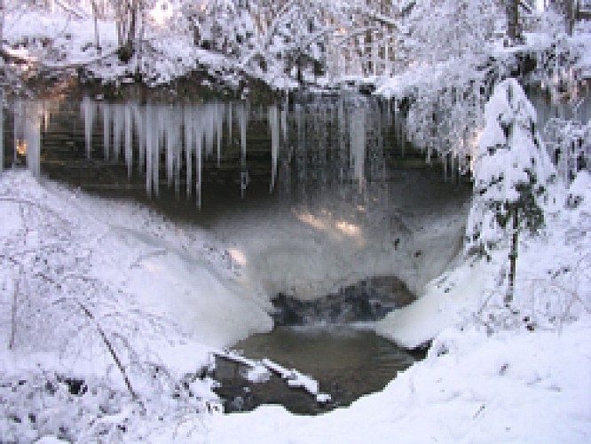
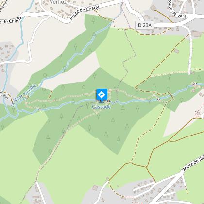
Cascades du Nant Trouble
De part et d'autre de l'endroit où l'on franchit le Nant Trouble sur un petit pont de bois, deux cascades ajoutent leur musique apaisante au charme de ce lieu privilégié.
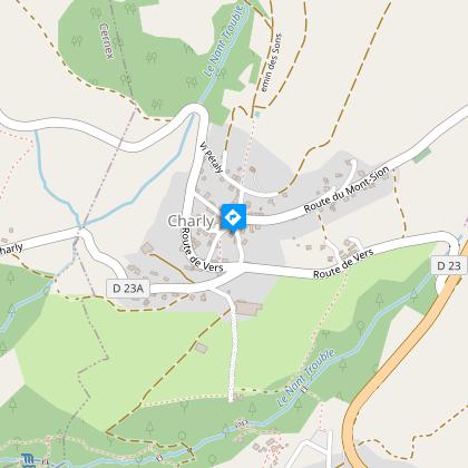
Chappelle de Charly - Andilly
La chapelle Saint-Jacques fut érigée au XV° siècle avant de se voir coiffée d'un pittoresque clocher à bulbe à la fin du XVIII°.
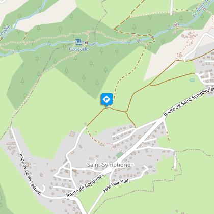
Point de vue de Saint-Symphorien
Alors que l'on approche de Saint-Symphorien par le sentier du Nant Trouble, à la jonction avec un chemin carrossable se dresse une croix qui fait un excellent point de vue champêtre sur la vallée des Usses.
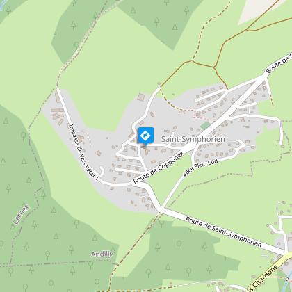
Accès au départ
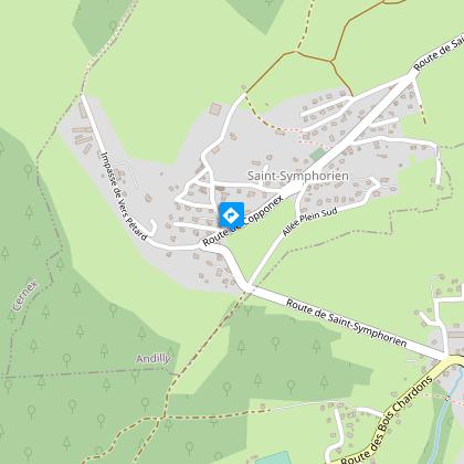
Le hameau de Saint-Symphorien (commune d'Andilly) se situe à l'écart de la route nationale 201 à hauteur de Jussy. Depuis Annecy, prendre la direction Saint-Julien-en-Genevois. Dépasser Cruseilles et Copponex pour bifurquer à gauche dans Jussy. Le parking se situe à l'église.
Vers le Nant Trouble
Depuis l'église, descendre la route en pente assez raide, puis prendre à droite à l'intersection. On dépasse "Chez Guillot" pour atteindre "Vers Pétard". Il y a là une grande ferme, avec derrière un chemin herbeux qui permet de longer la forêt.En continuant sur le même chemin on pénètre dans la forêt avant d'atteindre quelques marches qui mènent à la cascade. Franchir alors le ruisseau du Nant Trouble sur un pont de bois.
Remonter vers Saint-Symphorien
Après le passage du pont le sentier remonte la pente le long du ruisseau. Laisser sur sa gauche le sentier qui remonte vers Charly et traverser une clairière (tour médiévale en bois) pour traverser à nouveau à droite le Nant Trouble en direction de Jussy et Saint-Symphorien. Traverser les champs, profiter du point de vue à la croix et continuer tout droit sur le chemin carrossable vers Saint-Symphorien.
Points of interest
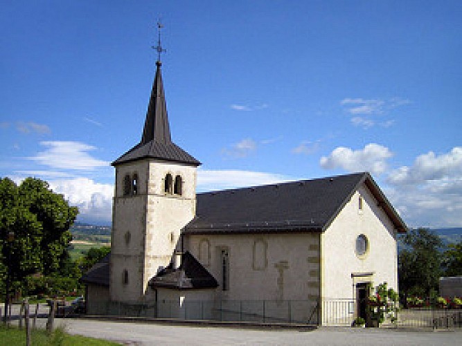
Eglise de Saint-Symphorien
Charmante église dotée de panneaux de bois sculpté. La cure propose des expositions et un jardin d'ornement au son du carillon.
Point de vue de Saint-Symphorien
Alors que l'on approche de Saint-Symphorien par le sentier du Nant Trouble, à la jonction avec un chemin carrossable se dresse une croix qui fait un excellent point de vue champêtre sur la vallée des Usses.
Additional information
Guidebook with maps/step-by-step
1. In front of the church (basin) and near the Cure exhibition center, descend a small, steep road towards Vers-Pétard.
2. Turn right and, at the "Chez Guillet" sign, continue right downhill to the hamlet of Vers-Pétard (golf driving range, large farm).
3. Go straight ahead on the grassy path that runs alongside the forest before entering it.
4. Go down a few steps, past a waterfall overhanging a molasse bank, along the stream, then cross it on the small wooden bridge and climb back up the narrow, damp and sometimes shifting path. Pass a second waterfall on the right and enter a clearing topped by a medieval wooden tower.
5. Take a path to the right which climbs up along the nant trouble.
6. Take the path down towards Saint-Symphorien.
7. Continue down the gently sloping path (panoramic views of the Bornes and Bauges massifs) and return to the starting point.
Tips
Copponex has a Romanesque church, a press, a bread oven and a vicarage. Communal gîte in the hamlet of Charly. Follon Farm in Copponex to buy good local produce. In Jussy, you'll see old houses and a bread oven.
Environments
In the country
Updated by
Office de Tourisme des Monts de Genève - 26/03/2024
www.montsdegeneve.com
Report a problem
Open period
Throughout the year : open daily.
Tricky passages
During your hike, there may be a risk of muddy passages.
Type of land
Ground
Hard coating (tar, cement, flooring)
Not suitable for strollers
Contact
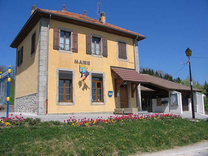
Phone : 04 50 44 21 43
Email : mairie@andilly74.fr
Location complements
There may be muddy stretches on the walk.
Data author
