Sappey Path
Description
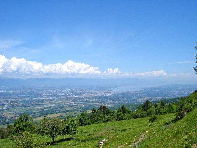
This walk takes you along a quiet forest track up to the Grand Piton. You will walk from the rural slope of Les Bornes to the highest point in the Salève range, overlooking Geneva and the surrounding area.
Route directions:
1. Go up to the church, take the path that goes up inside a hedge and reach the forest. On the edge, follow a forest path to the left. After a sharp bend, come out at the end of a forest road (1140m).
2. Don't take this path, but continue on the path which climbs the wooded slope. Reach the edge of an alpine pasture at Creux-du-Loup. Turn left and continue through the undergrowth. Come out at the grazed clearing of Pré-Fauraz (1275m).
Locate the return path to the left.
3. Follow the forest edge to the right, cross the D41, pass the obstacles (parking, picnic area) and climb Le Grand Piton to the summit (1379m, Bastian tower, view of the Geneva basin and the Jura).
4. Descend through the grazed clearing of Pré-Fauraz.
5. Fork to the left and, at the signpost, enter the undergrowth. The path crosses a small meadow (ruin, huge oak tree), then goes down the slope taking "châbles" (sunken roads dug in the past by the repeated passage of oxen pulling wood).
6. At the crossroads of four paths (signpost), near to an oratory, take the path which descends towards the hamlet of La Grange. Continue on the road then, at the bend, take the path which leads to Clamant.
7. Take the D15 to the left, go past a restored cabin (old customs post of the tax free zone) then the wooden "Le Salève" sign.
8. Take the path to the left which goes along the forest edge then, parallel to the road, leads to the church of Sappey,
Technical informations
9 km
|
min. 99999 m
533 m
533 m
| |||
Altimetric profile
Starting point
Points of interest
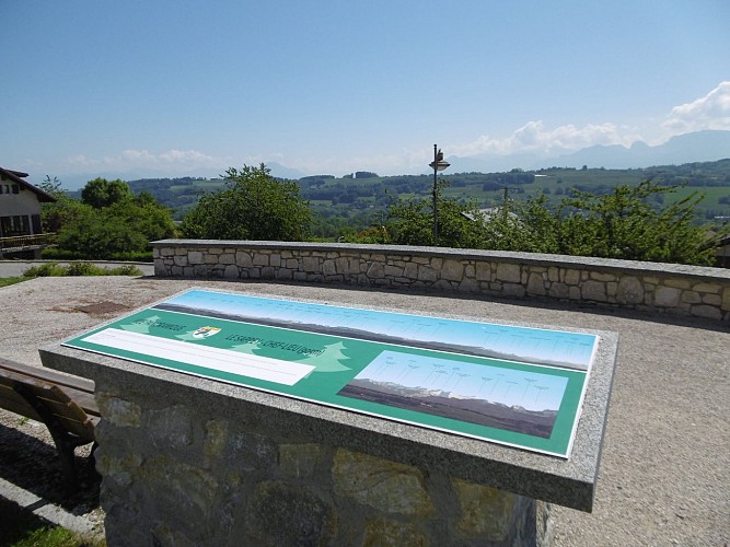
Table d'orientation - Le Sappey
La table d'orientation du Sappey vous offre une vue panoramique sur les nombreux massifs alentours.
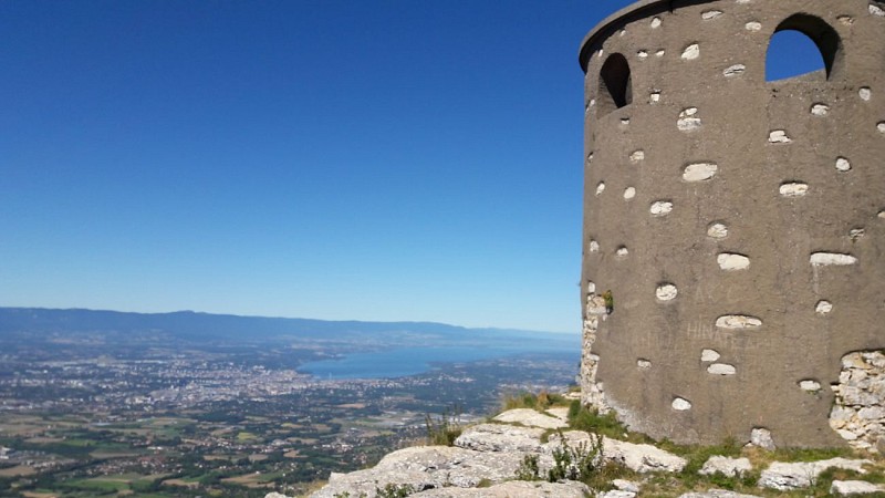
Point de Vue Le grand Piton
Le Grand Piton is the highest point of Le Salève offering a view mainly focused on the Genevois region and Jura.The tower was built between 1820 and 1830 by Claude-François Bastian, a wealthy notary and mayor of Frangy. Prior to the construction of this tower, this small plateau on the edge of the cliff, which features some of the Salève's finest lapiaz, was home to a 14th-century lookout post. At the foot of the tower to the north-east, you can enjoy finding a cartouche engraved on the limestone with the names of Lord Byron and Lamartine. Also on this site is Rocher de la Sorcière, a large limestone boulder popular with climbers, whose shape evokes a stern-looking old woman.
Additional information
Tips
Visit the silica quarry site in Vovray-en-Bornes nearby. At the top of the Sappey, don't miss the "Devil's Cave" next to the restaurant of the same name and, in Cruseilles, the Dronières Park is worth a visit for its lake, swimming pool, tennis courts, zoo, trim course and aerial assault course.
Environments
Mountain location
Updated by
Office de Tourisme des Monts de Genève - 26/03/2024
www.montsdegeneve.com
Report a problem
Open period
Throughout the year : open daily.
Tricky passages
You may encounter some steep passages during your hike.
When crossing alpine pastures, please respect fences, watering holes and livestock. Keep your dog on a leash.
Contact
Phone : 04 50 44 02 31
Email : mairie.lesappey@wanadoo.fr
Website : www.lesappey.fr/
Location complements
Departure from the church
Data author
