Xoldo


Description
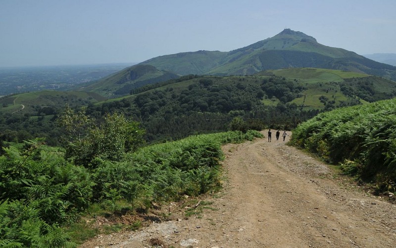
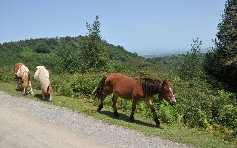
The village of Biriatou, charming and typically Basque, is divided into districts between the Bidassoa valley and the green hills. It gives access to a height that many consider to be the first French Pyrenean summit, the Xoldo (the extension gaina meaning summit in Basque). Its ascent is above all an opportunity to enjoy an incredible panorama, not so far from the Atlantic coast, from the bay of Saint-Jean-de-Luz to Biarritz and even beyond to the Landes beaches on a clear day. We often spend a lot of time comfortably seated on the summit grass, identifying a well-known village here, a beach there, or even finding the Abbadia castle or the Rocher de la Vierge. Between Peñas de Haya and the Rhune, you will end up heading towards the Col des Poiriers and dare to return to the cool undergrowth on the right bank of the Bidasoa.
Technical Information
Altimetric profile
Starting point
Steps
From Biriatou to the intersection of the high voltage line
Cross the square of the fronton of Biriatou (50m), go up the steps, take the alley just to the left of the Hiribarren inn, then go up the next street to the left, past the church. At the next intersection, turn right onto rue du GR10 (Mendiko Bidea). At the next Y-intersection, climb up the street on the right, marked in red and white. At the end of the tarmac road (parking lot), continue to climb up the gravel path on the right. After a few hairpins bends and a gate, walk straight on the main path until you reach an intersection and the high voltage pylon.
The viewpoint of the Rocher des Perdrix and the summit of Xoldo
At the Errekaldea junction (159m), turn left and immediately right, to climb the rocky path that runs along the foot of the pylon. Slow down and climb straight up to the small cliffs. At the base of the Rocher des Perdrix, the path branches off to the left to pass by a viewpoint indicator (290m). Walk flat for 50m, then choose the path that climbs to the right. You can soon avoid a rocky steepness of the GR10 by a grassy path. Higher up, the very panoramic climb continues between ferns and gorse. The path joins another track coming from the left: continue straight up the Xoldo ascent on easier slopes now.
From the summit of Xoldo to the Pitare pass
After enjoying the view, cross the Xoldo summit (486m) and, begin the descent on a path. It describes two large curves and reaches the grassy Osin pass (371m): continue on the right path on the left, facing the Rhune. It quickly descends to the Pitare pass.
From the Pitare pass to the Ihiztoki wood
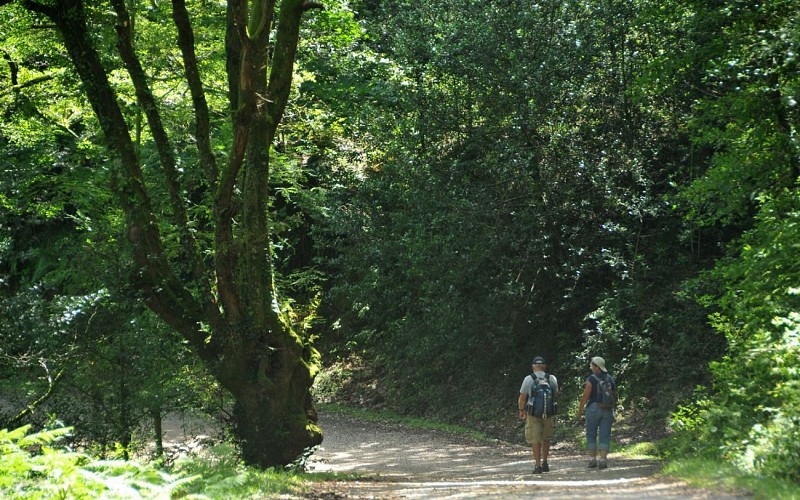
At the Pitare pass (316m), leave the GR markers to turn right onto a path that immediately splits into two branches: choose the one on the left that enters the forest. The path goes down the wood in two large bends and then runs alongside a stream. Once you reach a dirt track (221m), cross the stream and follow the track to the right. At the Lantzeraerreka crossroads (200m), follow the second track to the right. After 200m (Y-shaped intersection), be sure to leave the track and take the path on the left, through a tunnel of vegetation. At the end of a bend in the road, keep to the left downhill, then 80m further down to the right.
Return to Biriatou
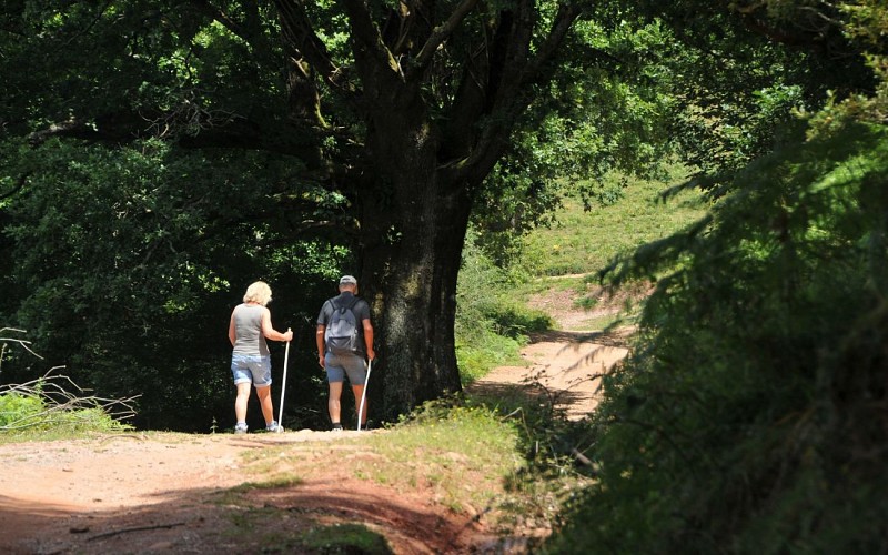
Right after a barrier, reach an intersection under a large oak tree (90m): be careful to choose the path that goes up to the right. At the top of the climb, go through a gate and then walk on the forest path on the edge of the fence. It then descends through several valleys and undergrowth. After a stream, the path starts to go up into the forest. At the Y-shaped intersection, ignore a track on the left and continue to climb on the right under the oak and chestnut trees. Right after passing under the high voltage line, find the path you took earlier, which you can take down to the left to return to Biriatou.
Points of interest

The fronton square of Biriatou
The Biriatou fronton, known as “en place libre”, offers a beautiful architectural ensemble between houses, stands, an inn and a pelota court (derive from the jeu de paume). You may have to opportunity to see young people from the village playing. A little further down the village, the Xoldo multi-purpose hall has a wall, also dedicated to pelota games.

The GR10
Many hikers walk this path that rises above Biriatou, some with a large backpack and the careful pace of a long-distance traveller. This is the beginning of the GR10, which allows you to cross the entire Pyrenean Mountain range from the Atlantic to the Mediterranean, that is to say about 870km of adventure!

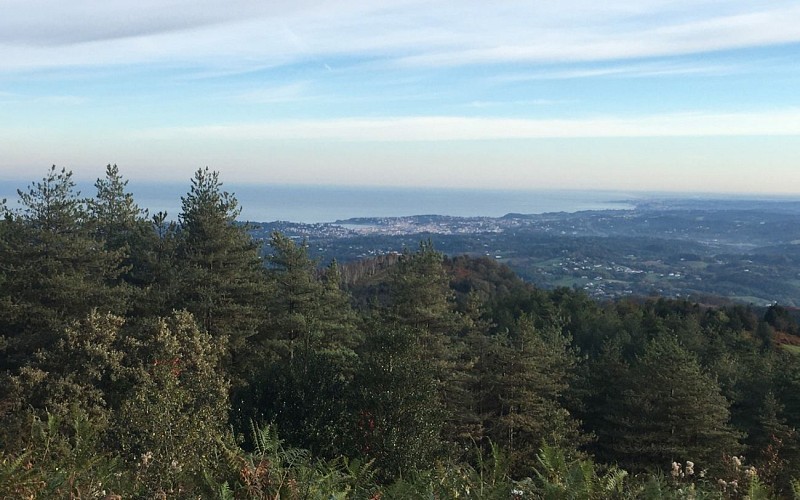
View of the Bidassoa delta
From the summit of the Xoldo you can see the entire coastline. If you linger on the Bidasoa delta, you can find islands of vegetation untouched by construction between Irun and Hendaye. These are preserved areas, such as the Plaiaundi, which is well worth a visit. The Bidassoa river is 66km long and rises in the Navarrese part of the Pyrenees. Although its first section is known as the Baztan river, from the town Orono-Mugaire it becomes the Bidasoa river.

The holly
The path passes through a grove of holly trees, recognizable by their green to red berries when ripe, and above all, their shiny leaves with prickly edges (branches that adorn Christmas tables). Notice how, having gained height and now out of reach of grazing animals, the leaves get rid of their prickles.

The Pitare burial mound
The area of the Col des Poiriers (or Pitare) is known for its density of tumulus-cromlechs, funerary monuments dating from prehistory to Antiquity, taking the form of a pile of soil and stones. They can be found as soon as you enter the Pitare wood, even if the vegetation makes it difficult to observe them.
Additional information
Balisage
Yellow
Balisage GR (rouge et blanc) pour les tronçons 1 à 3, PR (jaune) pour le retour
Typologie de l'itinéraire
Loop
Durée moyenne de l'expérience
3 to 4 hours
Equipements
Water point
Thèmes
Natural
Data author
