Alert
Alerts
On the hills of the Voulzie river
Description
From the Brie plateau, covered with fields, route leads you over both sides of the valley created by the Voulzie river. Mills and then industries settled along this river, urbanizing the wooded valley by a string of villages, some of which have become cities.
Technical Information
Altimetric profile
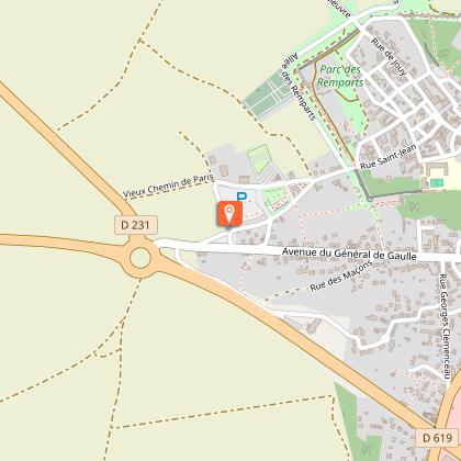
Starting point
Steps
Additional information
Tips
• Do not leave the marked paths.
• If there are any doubts regarding which path to take, markings take precedence over the description.
• Respect nature and private property.
• Don't litter.
• Avoid routes during hunting season (check with the town halls or the Seine-et-Marne hunting federation).
• Close gates and fences after you.
• Whenever possible, remove any obstacles from the path..
Contact
Phone : 01 64 60 26 26
Email : info@provins.net
Website : www.provins.net
Updated by
Provins Tourisme entre Bassée, Montois et Provinois - 12/06/2025
www.provins.net
Report a problem
Open period
All year round.
Guidebook with maps/step-by-step
1- Leave the tourist office car park, turning right onto the road. Cross the roundabout of D619 / D231 (use caution) and follow the path to the left for 700 m. At the fork, take the path on the right, and the street on the left before "Le Mez de la Madeleine” hamlet.
2- Turn right and then left. Follow D106 to the left, go down the road to the right and the path to the right. Cross Varailles ravine (springs), walk down a wide path and follow the path on the right which runs on the hillside.
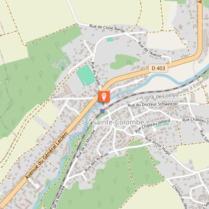
3- Pass Ste-Colombe church and the cemetery and turn right along the cemetery. Turn left and then enter the town of SteColombe by the road on the right that becomes a street.
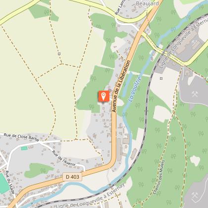
Walk down along the outer wall of the old leper colony. Cross the Voulzie aqueduct, walk past the stadium, cross D403 and cross the Voulzie river.
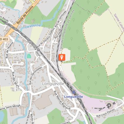
4- Turn right before the railway (Ste Colombe railway stopParis-Provins Line). The street becomes Le Chemin de la Voulzie.
At the road make a left-right, pass under the railway bridge and follow the railroad tracks to the right. Turn left at the edge of the woods (Longueville train station 700 m to the right by following the white-red markings).
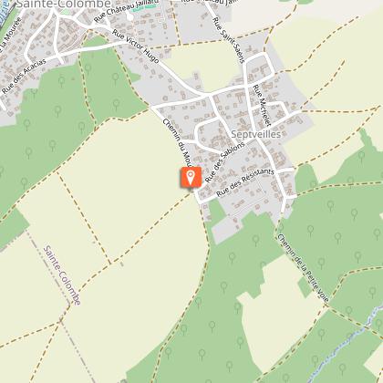
5- Walk up the path to the left through the undergrowth, continue on the plateau, pass the water tower and reach Septvieilles-le-Haut.
6- Walk down to the left, Chemin du Moulin, turn right at the crossroads (the lane changes names 3 times !) and walk through the village. At the exit, the street turns left; at the next bend, follow the path in front of you which descends 1.4 km in the same direction.
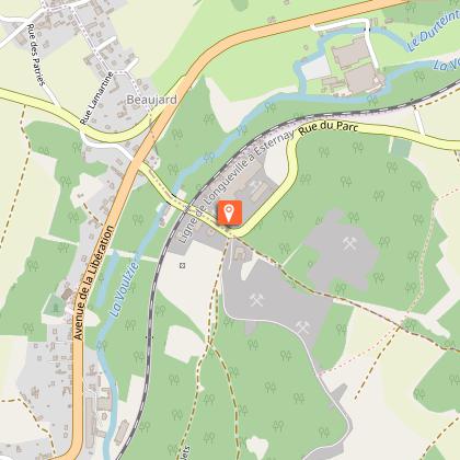
7- Go up the road on the right, cross a sand quarry area and at the top of the hill, go down to the left. Walk along the village of Poigny on the right, turn left onto the street and then left again. Follow D1E to the left, go right and pass under the railroad tracks.
Cross the Voulzie, the Durteint and, by the path on the right, pass under D403 to go up the hill. Turn right on the road that becomes a path, cross the plateau, turn left to find point "2". Return to the car park by the same route as on the outward journey.
