Alert
Alerts
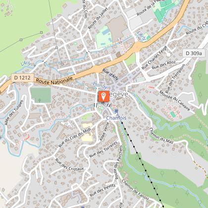
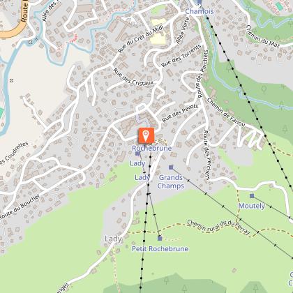
Cassioz trail course
Description
Course N°1 blue "Cassioz"
This route will offer you a panorama on the Aravis chain and the Charvin mount.
Level of difficulty: average, 90 % tar.
From the Tourist Office, head towards Praz sur Arly by the hilly road of Crêt du Midi to the residence "la Renardière".
From this road begins a long descent with a small percentage towards Cassioz, where you have to take a left until a path that will lead you to the road of Leutaz.
At the summit, the climax of the route, take the road towards Rochebrune, to return to Megève.
Technical Information
Altimetric profile
Starting point
Points of interest
Additional information
Updated by
Mairie de Megève - 26/03/2026
mairie.megeve.fr
Report a problem
Environments
Mountain view
Tips
Free running trail markers available in Megève Tourisme.
Open period
From 01/01 to 31/12.
Subject to snow conditions.
Type of land
Hard coating (tar, cement, flooring)
Contact
Phone : 04 50 21 27 28
Email : megeve@megeve.com
Location complements
Parking possibility at the Tourist office parking lot.
Access to the starting point with Meg'bus stop "Office de tourisme" (during high season only)
Animals
Yes
Data author
