Alert
Alerts
GR®223 - Genêts - Pontaubault


Description
At the start of this 22 km stage, you’ll go around the village of Genêts, walking next to the salt meadows. When you get to a gabion wall, go along the edge of the meadows and climb over the stiles to get to the Pointe du Mont Manet then Les Porteaux. Next, you’ll go past Le Grand-Port. Note: with very high tidal coefficients, it’s best to take the coastal road between Le Grand-Port and Le Rivage hamlet.
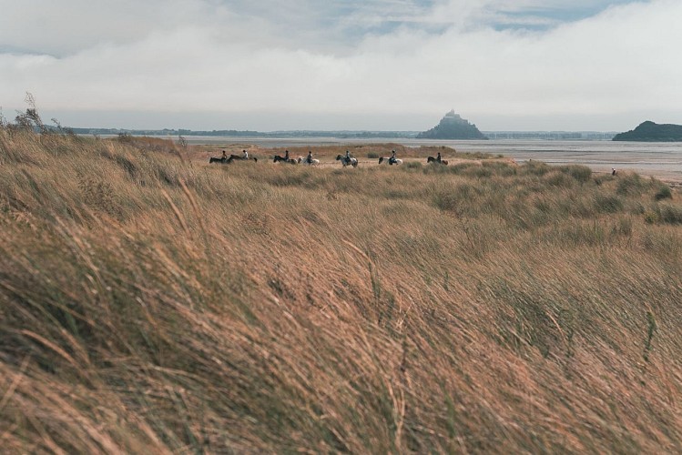
The path alternates between salt meadows and roads on the way to the rocky headland at Grouin du Sud, where you’ll have a superb view of the Bay of Mont Saint-Michel. This is where the Sée and Sélune streams meet to form a river. During the spring tides, you can watch the famous “mascaret” tidal bore here. This “wall of water” goes up the river an hour and a quarter before the high tide.
Next, the coastal path takes you to a bridge that you’ll cross before getting back to the salt meadows. Walk alongside the racecourse that takes you to the departmental road (D911). Next, take a path parallel to the road along the river to the footbridge over the Sée.
From here, if you want to explore Avranches, you can follow the GRP path “Les Belvédères du Mont Saint-Michel”. It takes you into the town centre and you can get back on the GR®223 in Bouillé via the GR®22.
If you carry on following the GR®223, turn right after going over the footbridge. The road goes through Les Plataines, La Roche and Mirey. From Mirey to Bouillé, you’ll walk through the saltmarshes surrounded by herds of sheep (don’t disturb them).
During the spring tides, it’s better to take the road. From Bouillé, carry on this section along the road to Gué de l’Epine. At Moulin de Flaget, you’ll enter the saltmarshes again. Between here and Pontaubault, the path alternates between roads and salt meadows.
Technical Information
Altimetric profile
Starting point
Additional information
Markup
Full route : Hiking - Red and white
Data author
