Alert
Alerts
Summer Hiking trail loop from village to Rochebrune - Cote 2000
Description
A lovely hike with stunning views of Mont Blanc, the Mont Joly range and the Monts de Véry mountains, surrounded by alpine pastures.
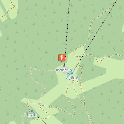
From the centre of Megève, take the Route des Perchets (1,200 m) towards the Rochebrune cable car, leave the tarmac road and follow the footpath to the Hameau du Tour (1,315 m). Take the first path on the right that climbs through the woods towards the Alpette chairlift (1,864 m). The path climbs steeply to the right through the woods (very steep section until the plateau), allowing about 35 minutes.
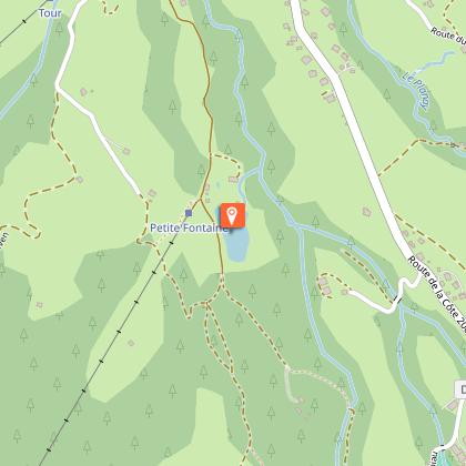
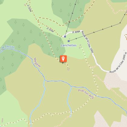
Continue along the path towards the Chalet Lupo restaurant (1,858 m) and Alpage de Pré Rosset (1,888 m), then continue towards Cote 2000. Take the path that follows the ridge line, then take the path on the left, below the first ski lift, which descends above Alptiport and arrives near the paintball field. The descent takes about 1 hour 30 minutes.
The hike continues on the paved road from the Le Petit Lay restaurant (1,400 m) to the hamlet of Le Maz (1,310 m) and towards the village centre, with a walking time of approximately 1 hour 15 minutes. You can take the free Line 2 shuttle bus from the Le Petit Lait restaurant stop and descend to the village.
Technical Information
Altimetric profile
Starting point
Points of interest

Date and time
- From 01/05/2026 to 30/11/2026
- From 01/05/2027 to 30/11/2027
Additional information
Updated by
Mairie de Megève - 29/03/2026
mairie.megeve.fr
Report a problem
Environments
Mountain view
Mountain location
Topo guides and map references
Map references :
Map of the ‘Belvédères du Mont-Blanc’ hiking trails on sale at the Tourist Office.
Open period
From 01/05 to 30/11 daily.
Subject to snow conditions.
Type of land
Not suitable for strollers
Ground
Contact
Phone : 04 50 21 27 28
Email : megeve@megeve.com
Guidebook with maps/step-by-step
0/ From the centre of Megève, take the Route des Perchets (1,200 m) towards the Rochebrune cable car.
1/ Leave the paved road and follow the footpath to the Hameau du Tour (1,315 m).
2/ Take the first path on the right that climbs through the woods towards the Alpette chairlift (1864 m). The path climbs steeply to the right through the woods (very steep section until the plateau), allowing about 35 minutes.
3/ Continue along the path towards the Chalet Lupo restaurant (1858 m), Alpage de Pré Rosset (1888 m).
4/ Head towards Cote 2000, taking the path that follows the ridge line.
5/ Take the path on the left, under the first ski lift, which descends above Alptiport and arrives near Paintball. The journey takes about 1 hour 30 minutes.
6/ The hike continues on the paved road from the Le Petit Lay restaurant (1,400 m) to the hamlet of Le Maz (1,310 m) and finally to the village centre. Walking time is approximately 1 hour 15 minutes.
7/ You can take the free shuttle bus Line 2 (summer) from the ‘PETIT LAIT’ stop and get off in the village.
Animals
Yes. Dogs must be kept on a lead.
Data author
