Alert
Alerts
Hiking trail : Lake Javen
Description
A family walk. At Lake Javen, restaurant, children playground. Leisure site (Javen Loisirs) and fishing (fee applies). And as a backdrop admire the Aravis massif, you will see the Aiguilles de Varans and the fine line of the Aiguille Croche.
Opposite Megève Tourisme, take rue du Dr Charles Socquet, continue along route des Perchets, and after a short climb, turn right towards chemin de Lady. Then follow the signs for Le Tour and Lac de Javen.
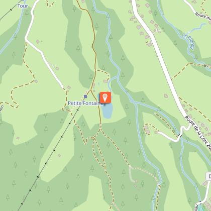
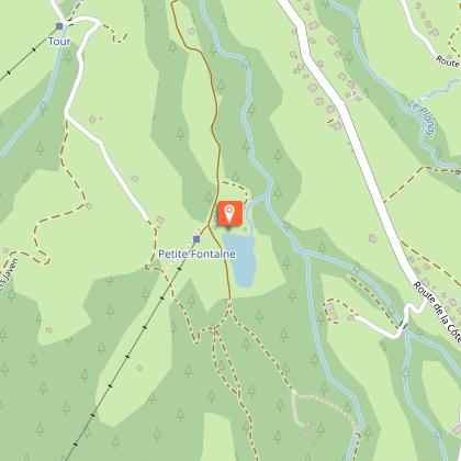
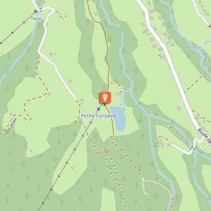
You will pass close to the Caboche cable car. Continue along route du Tour, following the signposts. At the end of the road, with the Tour ski lift on your right, take the path straight ahead that climbs through the woods (Le Babotch restaurant and La Petite Fontaine).
After about a 30-minute walk, you’ll reach the lake (restaurant, children’s play area, leisure centre (Javen Loisirs) and fishing area, fee applies).
For the return journey, there are several options:
- Follow the same route as on the way up.
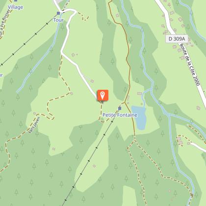
- At the hamlet of Le Tour, take the chemin de Fanou then the route des Perchets.
- Take the track to the Pont de la Rée; the path through the woods on your left leads to the hamlet of Le Tour, then head down via the Chemin de Fanou and the route des Perchets.
- At the Pont de la Rée, join the route du Tour, turn right towards Le Maz (for 400m), and opposite the chapel, return to the village via the chemin du Maz.
Allow 1 hour for the descent.
- You can take the Meg’bus, get off at the Maz chapel, then take the Route Ed. de Rothschild to the “Le Planellet” stop. Subject to current timetables.
Technical Information
Altimetric profile
Starting point
Points of interest
Date and time
- From 01/06/2026 to 04/06/2026
- From 05/06/2026 to 01/11/2026
- From 05/06/2027 to 01/11/2027
Additional information
Tips
2 options to reach the lake :
- Park at Rée – drive in the direction of Mont d’Arbois/Tour; take the road on the left before the bridge and then the Chemin de la Rée on the right and park near the bridge. The lake is a 20 min walk from here
- park at the hamlet of Tour (small car park opposite the drag lift). The lake is a 30 min walk from here.
Updated by
Mairie de Megève - 26/05/2026
mairie.megeve.fr
Report a problem
Environments
Lakeside or by stretch of water
Mountain view
Waterside
Lake view
Open period
From 01/06 to 04/06/2026 closed .
Chemin de le Rée is closed due to roadworks.
From 05/06 to 01/11 daily.
Until September 30: Access to the lake closed from Monday to Wednesday included.
Subject to favorable weather.
Contact
Phone : 04 50 21 27 28
Email : megeve@megeve.com
Type of land
Ground
Not suitable for strollers
Location complements
Parking available at the Tourist Office parking lot.
Topo guides and map references
Map references :
Trail available in the free trail guide distributed at the tourist office.
Guidebook with maps/step-by-step
0/ Opposite Megève Tourisme, follow signs for Musée du Haut Val d'Arly,
1/ continue on the route des Perchets,
2/ after a short climb, turn right towards chemin de Lady.
3/ Then follow signs for Le Tour and Lac de Javen.
You'll pass the Caboche gondola (restaurant).
4/ Continue along the Tour road, following the signs.
5/ At the end of the road, with the Tour ski lift on your right, take the path leading up into the undergrowth, (Le Babotch restaurant and La Petite Fontaine).
6/ After a 30-minute walk, discover the lake (restaurant, fishing site and children's play area).
7/ For the return journey, there are several options: take the same route and/or a variant on the Fanou path. At the hamlet of Le Tour, turn left at the last renovated farmhouse and take the path back down to the center of Megève via the Chemin de Fanou and the Chemin des Perchets.
8/ Take the carriage road as far as Pont de la Rée, and the path through the undergrowth on your left leads to the hamlet of Le Tour.
9/ At the Pont de la Rée, join the Route du Tour, turn right towards Le Maz (400m), opposite the chapel and return to the village along the Chemin du Maz.
Allow 1 h for the descent.
Alternatively, take the Meg'bus down to the Le Maz chapel, then take the route Edmond de Rotschild downhill to the "l'angne" stop. According to schedule.
Animals
Yes. Dogs must be necessarily kept on a lead.
Data author
