Hiking Trail: Le Sapin Président (President Fir) - from Le Besseray
Description
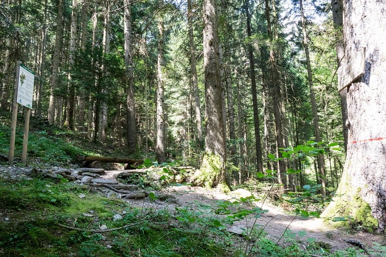
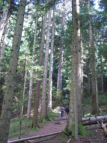
Long version of the forest walk to discover the famous President Fir, the majestic King of the Forest!
You will depart from the heights of St Martin and follow the forest path.
Very beautiful countryside for children to explore at 1000m altitude.
Departure: Besseray car park, in the hamlet of Saint Martin / sur Arve, at the top of the Reninge road.
1. Follow the semi-tarred road, then the path towards Véran.
2. Always continue straight on the main path, you will pass near Petit-Arvet then Grand Arvet (where there is a second mountain car park).
3. Continue a little higher still, after this 2nd parking lot, and on the right you will see a sign announcing the small path which will lead you to the "Sapin Président".
4. Walk around 10 minutes to reach this majestic "King of the Forests".
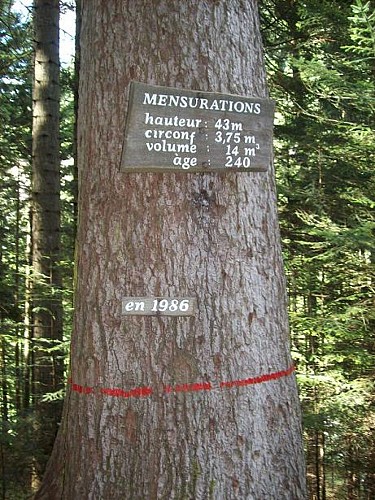
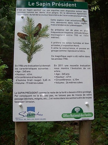
superb 265-year-old coniferous tree, remarkable for its measurements: 47 m in height and 4.10 m in circumference (2011 figures).
5. Return by the same route
Walking time is approximate and does not include break times.
Go on a safe hike!
This description allows you to orient yourself globally but does not replace a hiking map at 1/25000 or other topoguides that you can find in your tourist office! In Sallanches, our Office of Guides & Accompanists also offers a wide choice of outings accompanied by mountain professionals providing you with complete expertise on the environment and alpine nature, think about it!
Whatever your hike, check the weather before heading out.
Remember to take cereal bars, sufficient water, sunglasses, sunscreen, a small first-aid kit, as well as clothes suitable for your outing depending on the season in your backpack. and the forecast forecast.
Technical informations
5.6 km
|
min. 99999 m
547 m
547 m
| |||
Styles : HikingMountainForest Public : FamilySuitable for beginners | ||||
Altimetric profile
Starting point
Points of interest
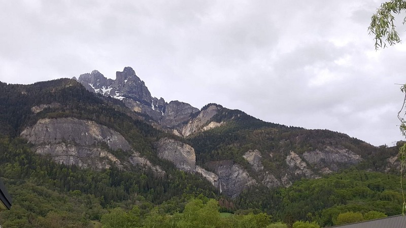
La Cascade de Reninge (waterfall)
Charming small waterfall on the hillside of St Martin, very visible in the spring. Taking its source in the Fiz mountain range, it continues its course in the Torrent de Reninge, then in the Arve.
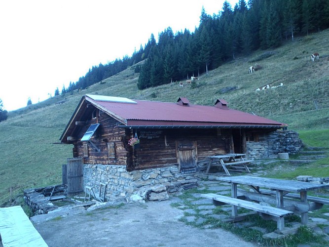
Refuge de Véran
Refuge non gardé. Réservations et clefs auprès de M. Michel Coudray au 06 88 63 15 28. L'été le refuge est surveillé par des bénévoles. Seuls couchages et utilisation de la cuisine sont possibles. Pas de ravitaillement.

Le Sapin Président (President Fir)
Superb coniferous tree aged 275 years old (in 2021), with remarkable measurements: it is 47 m high and has a 4.10 m circumference (in 2011). It flourishes in the middle of the forest on the St Martin hillside, at about 1000 m altitude. This is a very pleasant place to visit with children.
Additional information
Environments
In the country
Forest location
Mountain view
Mountain location
Updated by
Office de Tourisme de Sallanches - 22/04/2024
www.sallanchesmontblanc.com
Report a problem
Open period
All year round.
Subject to favorable snow and weather conditions.
Contact
Phone : 04 50 58 04 25
Email : tourisme@sallanches.com
Website : www.sallanchesmontblanc.com
Facebook : www.facebook.com/sallanchesmontblanc
Type of land
Ground
Grit
Data author
