Alert
Alerts
Hiking circuit : La Faucille - Les deux Montronds
Description
Reach the crests of the Monts Jura for a spectacular panorama, accessible to most hikers. Through undergrowth and alpine pastures, this hike is accentuated by a rich and varied flora.
Starting from La Faucille, the climb progresses through the undergrowth and quickly offers beautiful views over the Pays de Gex valley. The panorama reveals the view of Lake Geneva, the Alps and Mont Blanc as you gain height. The section between Petit and Grand Montrond guarantees breathtaking views of the Hautes Combes du Jura, the Creux de l'Envers forest, the Pays de Gex and the Alps. The scenery is varied, alternating between dense forests and large, open alpine pastures, such as the Crozat, following dirt or sometimes rocky trails.
Technical Information
Altimetric profile
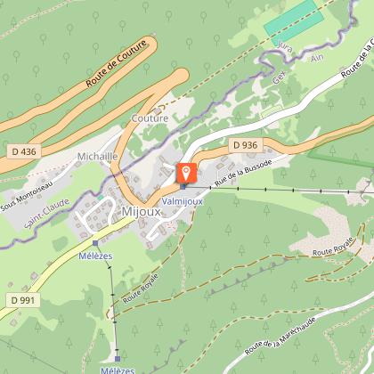
Starting point
Points of interest
Date and time
- From 01/04/2026 to 30/11/2034
- From 01/04/2027 to 30/11/2035
Additional information
Contact
Phone : 04 50 28 09 16
Website : https://www.paysdegex-montsjura.com
Open period
Closed temporarily.
Environments
Panoramic view
Lake view
Presence of livestock and guard dogs
Type of land
Ground
Not suitable for strollers
Topo guides and map references
Topo guides references :
Hiking in Pays de Gex and the Haute Chaine du Jura: on sale at Pays de Gex tourist agencies: 9€.
Map references :
3327ET - MOREZ LES ROUSSES
Updated by
Office de Tourisme du Pays de Gex - 29/01/2026
www.paysdegex-montsjura.com
Report a problem
Reception complements
▶ Before setting off :
Check the general and local weather forecast, and make sure there's no precipitation.
Find out about the approach route, the height of the itinerary, the time it will take to complete the climb, and any possible escapes (IGN map, GPS, topo-guide, etc.).
Evaluate possible risks by asking mountain professionals, mountain huts and gîtes.
Inform someone close to you of your objective, and contact them again in the event of any changes: departure and return times, number of participants with telephone numbers for each, vehicle(s), parking, etc.
Avoid setting off alone, and use equipment that is suitable for the activity, adjusted and in good condition: headlamp, complete first-aid kit, survival blanket, etc.
In the event of a problem, call 112 (European emergency number).
▶ The Patou or guard dog: what attitude should you adopt?
When out hiking, it's not uncommon to come across flocks of sheep or goats guarded by guard dogs known as patous. These dogs, formidable against predators such as wolves, bears and lynxes, can frighten hikers with their barking.
The patou protects flocks in total autonomy. Its main role is to deter intruders and alert the shepherd. Raised among the ewes from an early age, he learns to protect them at all times, often in groups.
▶ To avoid problems with a patou:
Identify grazing areas before setting off.
Keep your distance and go around flocks if possible.
In the event of an encounter, stay calm, turn back slowly or stop to let the dog sniff you out.
Don't try to pet or feed the animals, avoid sudden movements, don't run, and avoid taking photos.
▶ For runners:
Do not run when approaching a herd.
Take off your headphones to hear the dog's barking.
By adopting these behaviors, you'll be able to cohabit serenely with guard dogs on your hikes.
Guidebook with maps/step-by-step
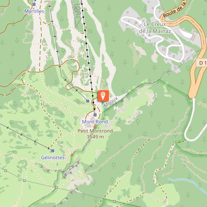
(1) From the La Faucille Tourist Office, follow the yellow signs to the white path that runs under the Montrond telecombi. It also passes under the toboggan track structure. A few metres further on, an intersection appears.
(2)Turn left to begin the ascent. The road becomes a path that slaloms through the trees, skirts the ski slopes and follows the ski lifts. Climb 419 steps to reach Petit Montrond. Along the way, you'll come across benches and viewing platforms.
(3)The view from Petit Montrond (1540 m) is breathtaking: a 360° panorama, with Mont Blanc, the entire Alpine arc, Geneva, the Pays de Gex plain and Lake Geneva in the background. From the panoramic table, turn right around the antenna and pick up the ridge path on the other side. It alternates between ascents and descents before reaching the next crossroads.
(4)At the Vie de Chaux crossroads, take the GR (red and white) towards Grand Montrond. After a short climb, a descent leads to a mountain pasture and a cistern. Go around it to the left, then start the final climb to the highest point.
(5)The view from Grand Montrond (1596 m) is just as spectacular. Enjoy the view, then retrace your steps to the Vie de Chaux crossroads. From here, turn left on the GR and descend along the pasture. The path enters an undergrowth and reaches the Gélinottes ski lift.
(6)The trail passes under the ski lift, crosses a white road, then enters the woods to the right of the tunnel of the Gélinotte ski run. The descent through the forest continues for around 1 km, until you reach the Maréchaude forest road.
(7)Follow this road to the right, heading back towards the resort. It passes close to the giant zip-line, then skirts the Faucille shops to return to the starting point.
Animals
No. The path which descends from Grand Montrond to La Faucille is subject to a decree during the summer period which prohibits dogs.
Data author
