Alert
Alerts
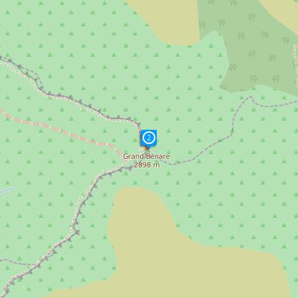
Le Grand Benare


Description
DURATION: 7 hours round trip
Signage: white paint on the ground
ITINERARY
two possible access points:
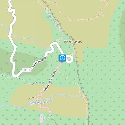
From Saint-Paul, take the direction of Maïdo. Go as far as the Piton Maïdo viewing point and park in the car park.
From Trois-Bassins, take the Tamarins forest road and park at the Tamarins gîte.
From Le Maïdo:
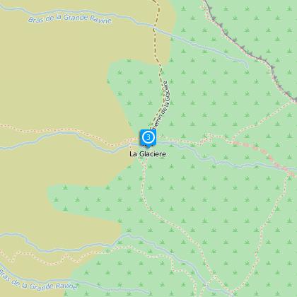
The departure point for this hike is at the far end of the car park, on the right opposite the ramparts. After 1 and a half hour's walking, you will arrive at an intersection where you need to turn left in the direction of Grand Bénare and the Mafate rampart. The path snakes along the rock face in the direction of the summit, which you will reach 3 hours 30 after your departure. You can reach La Glacière in 1 hour 45 from Grand Bénare or take the same route back to the car park at Maïdo.
Via Trois-Bassins
From the Tamarins gîte, walk for 2 hours to La Glacière. You will climb from 1,760m to 2,500m altitude.
Then allow 2 hours more to get to Grand Bénare.
This route is more difficult than going via Maïdo.
HISTORIC FOCUS
The whole region is a reminder of the epic history of the maroons in the 17th and 18th centuries. The first colonists settled in Saint-Paul, and it was in the high regions in this area where the first maroons fled to.
In Eugène Dayot's novel, "Bourbon Pittoresque", can be found an illustration of this epic "Commitment to the summit of Bénare".
Louis Héry remembers: "near there, is the Phaonce cave. This King of the maroons had his own guards, his hierarchy, his high justice, which consisted of expediting delinquents from the top of an escarpment 800 toises high..."
"BÉNARE" is a name given at the time by the maroons: Bé: very; naro: cold
PRATICAL INFORMATION: Protect yourself well from the sun, always carry water, the path is very pebbly, so wear good walking shoes. During the rainy season, gullies are created on the path.
Technical Information
Altimetric profile
Starting point
Additional information
Skill
Very Experienced Hikers
