Alert
Alerts
Type of practice
Walking
Easy
3h
Presentation
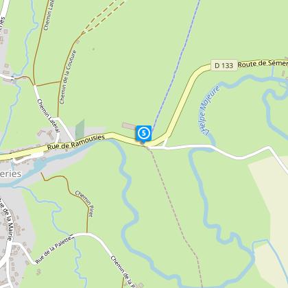
Map
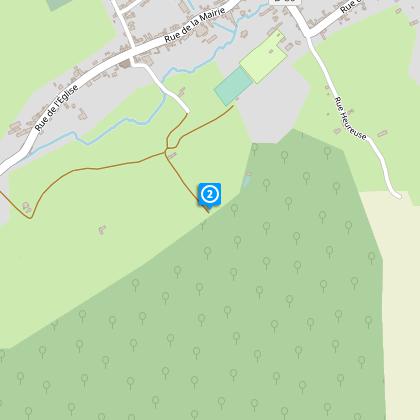
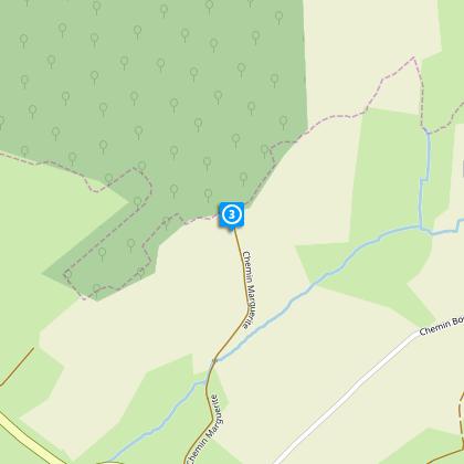
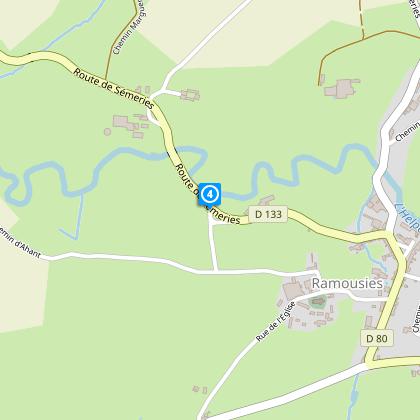
Steps
Points of interest
Cirkwi brief's
Ratings and reviews
See around
Path of the Ghostly Phantom

Credit : Nord Tourisme
The Cirkwi brief
Explore Avesnois' Natural Beauty: The Path of Discovery
Nestled in the serene landscapes of Avesnois, the Chemin de la fache d'ahant takes you through a remarkable journey filled with lush woodlands and captivating countryside views. This enchanting route, presented by Nord Tourisme, unfolds the hidden beauty of the Helpe Majeure's meanders and the biodiversity of the Bois de la Petite Villette. Feel the magic of nature's whispers as you traverse this trail, where each step leads to a dance with flora and fauna unseen elsewhere. Embark on this voyage to immerse yourself in the tranquility and raw beauty of nature, meticulously curated by enthusiasts who understand the call of the wild.
Brief Technical Overview
The trail spans approximately 10.4 kilometers and is marked with yellow signs, guiding you through varying landscapes. Boasting an altitude range from 153 to 219 meters, it tests your endurance with a total positive elevation change of 116-117 meters. This meticulously designed circuit by Nord Tourisme offers a modest challenge to hiking enthusiasts, providing a balance between leisurely walks and rigorous strides. Perfect for those who seek a blend of physical activity amidst nature’s allure, this trail is a testament to thoughtfully crafted outdoor experiences.
Seasonal Tips and Safety
When planning your adventure along this scenic trek, remember that each season offers a unique palette of nature's wonders. Spring bursts with vibrant wildflowers, while autumn cloaks the path in fiery hues of red and gold. No matter the season, sturdy footwear and weather-appropriate clothing are essential. Also, the trail's run-through protected areas demands adherence to guidelines; stay on the marked paths and refrain from disturbing the natural habitats. Lastly, always carry water and a charged mobile phone for a safe and enjoyable journey through Avesnois' enchanting landscapes.
Historical Significance Unveiled
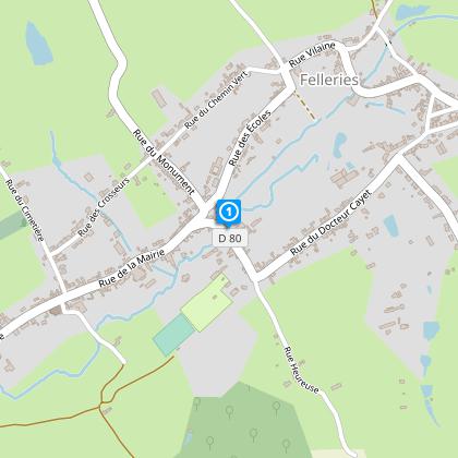
Felleries, a gem in the French Avesnois region, serves as the starting point for this verdant expedition. This village, alongside the broader Nord-Pas-de-Calais area, whispers tales of a rich past from its deep-rooted historical mills to the revered Musée des Bois Jolis. The region's narrative intertwined with crafts, industry, and the resilience of nature offers an insightful backdrop to your trek. By stepping onto this path, you not only explore the natural beauty but also traverse through layers of history that shaped this charming corner of France.
Insights into Local Weather and Best Visits
Avesnois boasts a temperate climate, making it a suitable destination for most of the year. However, for an optimal experience, visit between late spring and early autumn when the weather is milder, and the natural scenery is at its peak. Rainfall is evenly distributed throughout the year, so preparing for occasional showers regardless of the season is wise. To fully enjoy the scenic beauty and the diverse ecosystems along the Chemin de la fache d'ahant hike, timing your visit with this weather pattern in mind will enhance your exploration of this picturesque region.
Nestled in the serene landscapes of Avesnois, the Chemin de la fache d'ahant takes you through a remarkable journey filled with lush woodlands and captivating countryside views. This enchanting route, presented by Nord Tourisme, unfolds the hidden beauty of the Helpe Majeure's meanders and the biodiversity of the Bois de la Petite Villette. Feel the magic of nature's whispers as you traverse this trail, where each step leads to a dance with flora and fauna unseen elsewhere. Embark on this voyage to immerse yourself in the tranquility and raw beauty of nature, meticulously curated by enthusiasts who understand the call of the wild.
Brief Technical Overview
The trail spans approximately 10.4 kilometers and is marked with yellow signs, guiding you through varying landscapes. Boasting an altitude range from 153 to 219 meters, it tests your endurance with a total positive elevation change of 116-117 meters. This meticulously designed circuit by Nord Tourisme offers a modest challenge to hiking enthusiasts, providing a balance between leisurely walks and rigorous strides. Perfect for those who seek a blend of physical activity amidst nature’s allure, this trail is a testament to thoughtfully crafted outdoor experiences.
Seasonal Tips and Safety
When planning your adventure along this scenic trek, remember that each season offers a unique palette of nature's wonders. Spring bursts with vibrant wildflowers, while autumn cloaks the path in fiery hues of red and gold. No matter the season, sturdy footwear and weather-appropriate clothing are essential. Also, the trail's run-through protected areas demands adherence to guidelines; stay on the marked paths and refrain from disturbing the natural habitats. Lastly, always carry water and a charged mobile phone for a safe and enjoyable journey through Avesnois' enchanting landscapes.
Historical Significance Unveiled
Felleries, a gem in the French Avesnois region, serves as the starting point for this verdant expedition. This village, alongside the broader Nord-Pas-de-Calais area, whispers tales of a rich past from its deep-rooted historical mills to the revered Musée des Bois Jolis. The region's narrative intertwined with crafts, industry, and the resilience of nature offers an insightful backdrop to your trek. By stepping onto this path, you not only explore the natural beauty but also traverse through layers of history that shaped this charming corner of France.
Insights into Local Weather and Best Visits
Avesnois boasts a temperate climate, making it a suitable destination for most of the year. However, for an optimal experience, visit between late spring and early autumn when the weather is milder, and the natural scenery is at its peak. Rainfall is evenly distributed throughout the year, so preparing for occasional showers regardless of the season is wise. To fully enjoy the scenic beauty and the diverse ecosystems along the Chemin de la fache d'ahant hike, timing your visit with this weather pattern in mind will enhance your exploration of this picturesque region.
Automatically generated.
Technical Information
Walking
Difficulty
Easy
Duration
3h
Dist.
10 km
Type of practice
Walking
Easy
3h
Show more
Altimetric profile
Starting point
11
Ecomusée de Felleries, rue de la place
,
59740
FELLERIES
Lat : 50.1436175445Lng : 4.02589610125
Steps

Data author

Ratings and reviews
To see around