Alert
Alerts
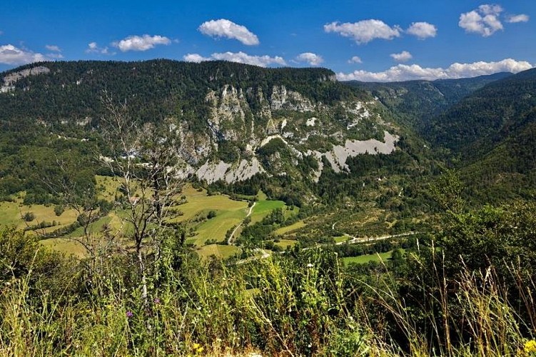
The Rancs de Charles
Description
Discover the forest environment at the foot of the Hauts plateaux du Vercors. If you are discreet and observant, you may be able to see the local fauna (chamois, deer, deer, eagles ...)
Departure of the hamlet-village of Rousset (parking), direction the Rancs of Charles 4.Take the road for some 300 meters to the crossroads of the Pont des Oules 1, continue on this one hundred meters before turning on the left to join a path that advances in laces in the middle of boxwood groves (Not missing in passing a small visit of the Chapel Saint-Alexis). At the Pont des Scies 2, the hike continues for a moment by a wide track before turning abruptly on the left to join the crossroads of the Château d'Eau 3.From there, the trail becomes more "mountainous and steep" (caution in rainy weather) and progresses in laces in a scree before joining the forest road of Béguère at the crossroads Rancs de Charles (point of view). The rest of the route follows the direction of Rousset, the track gradually descends into the undergrowth to reach the crossroads of the Barrière de Béguère 5.Go down to the Mémont 6, then always in the forest, continue until the road that crosses a second time to initiate the final slope leading to the Liottards 7.The return to Rousset is then made by Le Reservoir 8 then the Bridge of the Oules.
Technical Information
Altimetric profile
Starting point
Additional information
Advised parking
Parking hamlet of Rousset
Advice
Watch out for rain in the scree crossings!You may pass through pet parks along your hike. Thank you for closing the gates behind you and respect the tranquility of the herds.
Access
From the Balme-de-Rencurel, take the D103 towards Saint-Julien-en-Vercors, then Saint-Agnan-en-Vercors, passing Saint-Martin-en-Vercors. After Saint-Agnan, continue until the village of Rousset by the D518.From Die, follow the direction of Col de Rousset via the D518. After the Col continue towards Saint-Agnan-en-Vercors, until the village of Rousset.
Ambiance
This beautiful hike from the hamlet of Rousset in the valley of the Vernaison is mainly forest, but still presents some technical passages in the scree.
Arrival
Hamlet of Rousset, Saint-Agnan-en-Vercors
Departure
Hamlet of Rousset, Saint-Agnan-en-Vercors
