Alert
Alerts
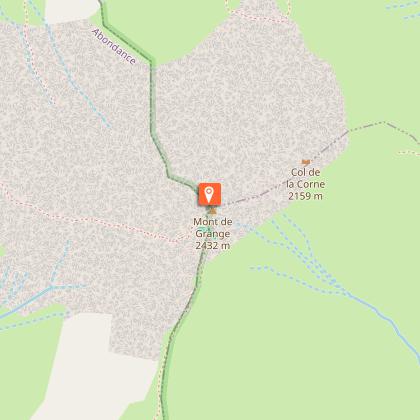
Walking route: Mont de Grange from Abondance - Saint Théodule Chapel
Description
The Mont de Grange (2432 m) is one of the most famous of the Massif du Chablais. At its summit, you will discover a view on the whole valley of Abondance, the mountains of the region, the lake of Geneva and the Mont-Blanc.
Mont de Grange is a 3,000-hectare nature reserve, classified Natura 2000. It's also a hunting reserve where deer, chamois, roe deer, mouflons, marmots, black grouse, ptarmigan and golden eagles live side by side... You can easily observe them early in the morning.
This hike also invites you to discover wild flora such as martagon lily, paradise lily, alpine columbine, gentian and genepi.
This challenging hike starts at Saint Théodule, Follebin in Abondance. You'll walk alongside the Chapelle Saint Théodule.
You then head for the Bailly and Jouly mountain chalets, on a carriage road overlooking Lac des Plagnes, with a magnificent view of Entre-Deux-Pertuis and Roc de Tavaneuse.
You'll then reach the Lenlevay chalets, where Abondance cows graze on the mountain pastures during the summer season.
You then take the GR5 path towards La Chapelle and the Crête de Coincon, a fairly steep path that leads to the summit of Mont de Grange. An orientation table shows you the various peaks of the French and Swiss Alps and the Jura.
Alternative: the climb can also be made from Pré la Joux in Châtel.
Technical Information
Altimetric profile
Starting point
Points of interest

Date and time
- From 01/06/2026 to 15/10/2026
- From 01/06/2027 to 15/10/2027
Additional information
Open period
From 01/06 to 15/10 daily.
Check with tourist offices in advance to find out the current access conditions.
Subject to favorable snow and weather conditions.
Updated by
Office de Tourisme Leman Mountains Explore - 10/03/2026
leman-mountains-explore.com
Report a problem
Environments
Mountain location
Contact
Phone : 04 50 73 02 90
Email : abondance@ot-peva.com
Website : https://leman-mountains-explore.com
Type of land
Rock
Stone
Ground
Grit
Not suitable for strollers
Location complements
The departure is in Abondance, in the center of the village, take the direction of the lake of Plagnes. On the road, after a big bend, turn left towards Follebin. Go up a small winding road. You will reach a road that can be driven on, continue until you reach a small parking lot.
Topo guides and map references
Topo guides references :
Hiking maps and guidebooks are available for purchase at tourist offices throughout the Evian and Abondance Valley region.
Map references :
- Map guide to 65 walks and hikes in the Evian region and Abondance valley
- Map of walking routes in the Portes du Soleil area in France and Switzerland
- IGN TOP 25 No. 3528 ET Morzine Chablais Massif Portes du Soleil
Reception complements
Whatever your hike, remember to take cereal bars, sufficient water, sunglasses, sun cream, a small first aid kit, as well as clothes adapted to your outing according to the season and the weather forecast.
Guidebook with maps/step-by-step
0/ Car park of "Saint Théodule" at "Follebin" in Abondance.
1/ Follow the path that leads to the Saint Théodule chapel and then take the direction of the "Chalets de Bailly" and the "Chalets du Jouly" by a carriage road.
2/ Then join the chalets of "Lenlevay".
3/ Take the path that goes up on the left, it is the GR5 in the direction of the "Crête de Coincon".
4/ After about 200 metres, take the path that goes up in the forest on the left "Crête de Coincon".
5/ Follow the path along the ridge, it will lead you to the top of the Mont de Grange.
Animals
Yes. Dogs must be kept on a leash due to the presence of livestock and wildlife.
