Alert
Alerts
Walking itinerary: Vuache summit from Chaumont
Description
Discover the Vuache mountain and its summit on this accessible hike between Geneva and Annecy. Smaller than its neighbor the Salève, this mountain offers equally magnificent panoramas!
This hike, which is not technically difficult but has a good gradient, takes you to the summit of the Vuache mountain at an altitude of 1110 meters, from the authentic village of Chaumont.
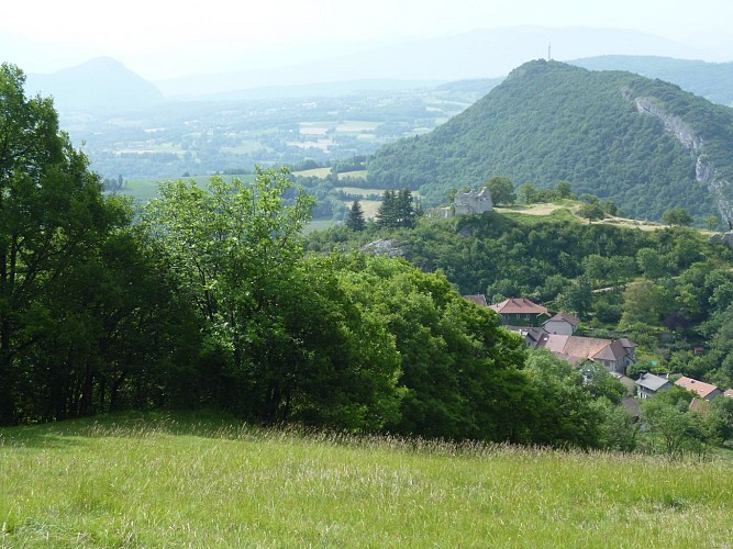
The 11-kilometer-long Vuache mountain is located in a natural area protected for its flora and fauna. Here you'll find rare flower species such as Erythrone Dent de Chien, which is also the symbol of the Syndicat Intercommunal.
From the summit, you can contemplate the Jura massif, the Alps and the Geneva basin. While you're in Chaumont, take the opportunity to visit the ruins of the 12th-century castle, once the châtellenie of the Counts of Geneva.
Technical Information
Altimetric profile
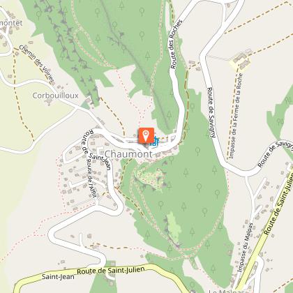
Starting point
Points of interest
Additional information
Open period
All year round.
Please check with the Tourist Office beforehand for current access conditions.
Subject to favorable snow and weather conditions.
Updated by
Conseil Départemental de la Haute-Savoie - 12/05/2026
hautesavoiemontblanc-tourisme.com/
Report a problem
Environments
Mountain view
Mountain location
Contact
Phone : 04 50 04 71 63
Email : ot@montsdugenevois.com
Type of land
Rock
Ground
Not suitable for strollers
Location complements
Access (by car): From Annecy, take the D1508 towards La Balme de Sillingy, then Frangy. Once in Frangy, follow signs for Chaumont.
Topo guides and map references
Map references :
TOP 25 IGN 3330 OT - BELLEGARDE-SUR-VALSERINE / CRÊT D'EAU FOREST
Reception complements
Whatever your hike, remember to pack cereal bars, plenty of water, sunglasses, sunscreen, a small first-aid kit, and clothing appropriate to the season and weather forecast.
Guidebook with maps/step-by-step
1/ From "Parking de Chaumont" follow "Chaumont Eglise".
2/ From the "Chaumont Eglise" post, follow the signs for "Sommet du Vuache", passing through "Chaumont(Nord)", "Le Mont" and "Sur la Montagne".
3/ Once you've reached "Sommet du Vuache", take the same route back to the parking lot.
Animals
Yes. Pets allowed on leash only
Data author
