Alert

Alerts

To see around
See more
Open
Close
Show
Show
Show
Show
Show
Show
Show
Show
Show
Show
Show

Oups... It would appear that Cirkwi does not have permission to use your location.

Presentation
Description
Map
Ratings and reviews
See around

Walking itinerary - Plaine du Fier (Right bank)

Walking itinerary - Plaine du Fier (Right bank)

IGN cards

3431OTR - LAC D'ANNECY RESISTANTE
Editor : IGN
Collection : TOP 25 RÉSISTANTE
Scale : 1:25 000
17.20€
3431OT - LAC D'ANNECY
Editor : IGN
Collection : TOP 25 ET SÉRIE BLEUE
Scale : 1:25 000
13.90€
TOP75032 - CHAINE DES ARAVIS - MASSIF DES BAUGES
Editor : IGN
Collection : TOP 75
Scale : 1:75 000
9.80€
TOP100D73 - SAVOIE CHAMBÉRY ALBERTVILLE PARC NATIONAL DE LA VANOISE PNR DU MASSIF DES BAUGES
Editor : IGN
Collection : TOP 100
Scale : 1:100 000
8.40€
TOP100D74 - HAUTE-SAVOIE ANNECY THONON-LES-BAINS MASSIF DU MONT BLANC CHAÎNE DES ARAVIS
Editor : IGN
Collection : TOP 100
Scale : 1:100 000
8.40€
TOP100D01 - AIN BOURG-EN-BRESSE AMBÉRIEU-EN-BUGEY PAYS DE GEX
Editor : IGN
Collection : TOP 100
Scale : 1:100 000
8.40€
202 JURA ALPES DU NORD
Editor : IGN
Collection : TOP 200
Scale : 1:200 000
6.80€
89026 - GRANDES TRAVERSÉES DU JURA - GTJ
Editor : IGN
Collection : DECOUVERTE DES CHEMINS
Scale : 1:105 000
9.10€
D38 ISÈRE
Editor : IGN
Collection : CARTES DÉPARTEMENTALES IGN
Scale : 1:150 000
5.90€
D01-69 AIN RHÔNE
Editor : IGN
Collection : CARTES DÉPARTEMENTALES IGN
Scale : 1:150 000
5.90€
NR14 AUVERGNE-RHÔNE-ALPES RECTO/VERSO MASSIF CENTRAL
Editor : IGN
Collection : CARTES RÉGIONALES IGN
Scale : 1:250 000
6.80€
NR15 AUVERGNE-RHÔNE-ALPES RECTO/VERSO MASSIF ALPIN
Editor : IGN
Collection : CARTES RÉGIONALES IGN
Scale : 1:250 000
6.80€
EUROPE
Editor : IGN
Collection : DÉCOUVERTE DES PAYS DU MONDE IGN
Scale : 1:2 500 000
7.00€
SUISSE
Editor : IGN
Collection : DÉCOUVERTE DES PAYS DU MONDE IGN
Scale : 1:303 000
7.00€

Description

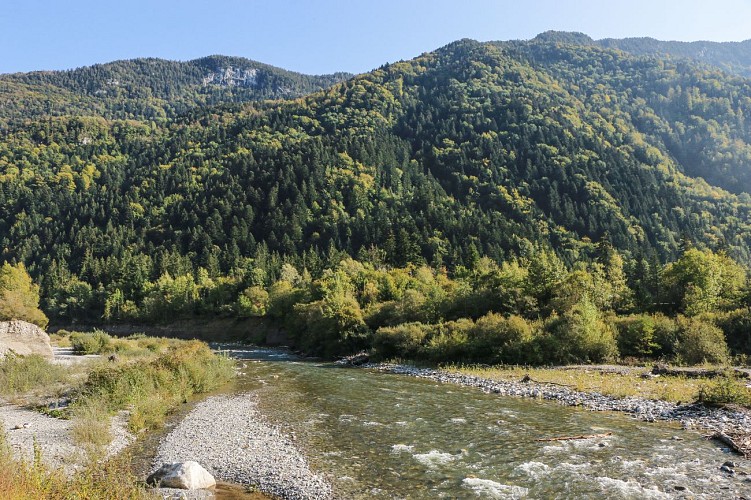
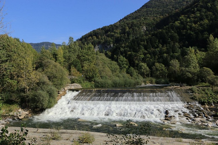
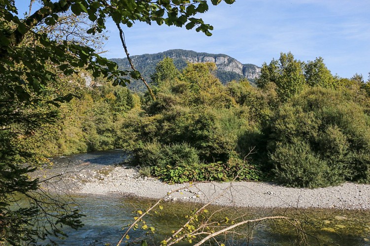
A beautiful walk along the landscaped paths on the banks of the Fier, ideal for walkers in search of fresh air. Discover this sensitive natural area from the Morette site to Provenat.

Stroller-accessible, this family outing will delight young and old alike for a moment of relaxation in the fresh air in the heart of the Thônes Valley, close to Annecy.

This itinerary takes you along the banks of the River Fier. On these shady paths in the heart of an alluvial forest, immerse yourself in the beautiful, unspoilt natural setting of this site.

Classified as a Sensitive Natural Area, the Fier plain is a typical Alpine valley floor site. Several educational panels will help you learn more about this ecosystem.

On warm days, don't hesitate to take advantage of the natural beaches along the route, for a moment of relaxation by the water.

Technical Information

Walking
Difficulty
Easy
Duration
5h
Dist.
14 km
Show more

Altimetric profile

Starting point

Site de Morette , 74230   La Balme-de-Thuy
Lat : 45.898816Lng : 6.289389

Additional information

Open period

All year round.

Subject to favorable snow and weather conditions.

Updated by

Conseil Départemental de la Haute-Savoie - 24/11/2025
www.hautesavoiexperience.fr
Report a problem

Environments

Riverside
Mountain view
Waterside
Overview on river

Contact

Phone : 04 50 02 00 26

Email : infos@thonescoeurdesvallees.com

Website : https://www.thonescoeurdesvallees.com

Type of land

Suitable for all terrain strollers

Location complements

Access (by car): From Thônes, follow signs for Annecy (D909). At the Morette site, turn left to reach the parking lot.

Topo guides and map references

Map references :
TOP 25 IGN 3430 ET - LA CLUSAZ / LE GRAND-BORNAND

Reception complements

Whatever your hike, remember to pack cereal bars, plenty of water, sunglasses, sunscreen, a small first-aid kit, and clothing appropriate to the season and weather forecast.

Guidebook with maps/step-by-step

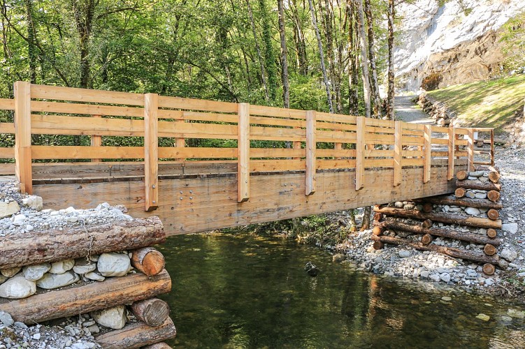
1/ From Morette (Parking), follow signs for "Abri Sous Roche par Morette (Passerelle)".
2/ At the "Morette (Passerelle)" sign, follow "L'Abri Sous Roche par La Scierie".
3/ At "La Scierie", follow signs for "Provenat". Continue in this direction, passing "Terrain du Rodéo Cascades", "Sous le Crêt", "L'île" and "A la Praz".
4/ Once you've reached the "Provenat" post, return to the starting point using the same route as the outward journey.

Animals

Yes. Pets allowed on leash only

Data author

Ratings and reviews

To see around
See more
Open
Close
Show
Show
Show
Show
Show
Show
Show
Show
Show
Show
Show
Caution!
We have no information on the difficulty of this circuit. You may encounter some surprises along the way. Before you go, please feel free to inquire more and take all necessary precautions. Have a good trip! 🌳🥾