Alert
Alerts
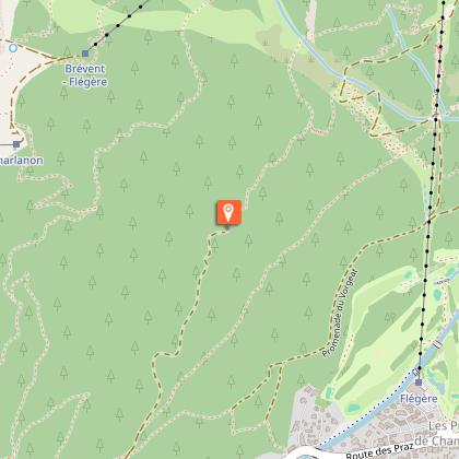
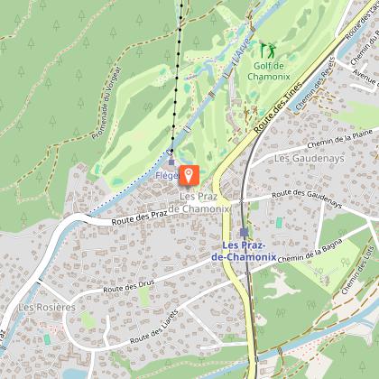
Hiking to la Flégère from Chamonix
Description
Pleasant hike in the forest. The panorama embraces the entire Mont-Blanc range. The view is very beautiful on the Mer de Glace.
Follow the signs for the Floria from the route des Nants. Once at the refreshment bar, continue on the path that climbs slightly and cross the Couloir des Lanchers. Stay continuously on the left side of the cable car and pass the Praz des Violles. The path crosses, then uses the ski run to reach the Flégère located above the Cornua forest.
Departure also possible from Les Praz or Les Tines.
More information available at the Tourist Office or the High Mountain Office and in our trail guide.
Attention : The conditions of the trails are likely to change, think of informing you before leaving.
Technical Information
Altimetric profile
Starting point
Points of interest

Date and time
- From 01/05/2026 to 31/10/2026
- From 01/05/2027 to 31/10/2027
Additional information
Updated by
Office de Tourisme de la Vallée de Chamonix-Mont-Blanc - 03/05/2026
www.chamonix.com
Report a problem
Environments
Mountain location
Open period
From 01/05 to 31/10 daily.
Subject to favorable snow and weather conditions.
Contact
Phone : 04 50 53 22 08
Email : ohm-info@chamoniarde.com
Website : http://www.chamoniarde.com/
Facebook : https://www.facebook.com/chamoniarde/
Type of land
Rock
Stone
Ground
Grit
Not suitable for strollers
Location complements
Closest bus stop: Vallot
Closest train stop : Chamonix train station
Closest parking : Saint-Michel car park
Animals
Yes
Data author
