Alert
Alerts
Lac Vert et Refuge de Terre Rouge par la Chenalette
Description
Nice walk on both sides of the Neuvache valley. The Lac Vert remains one of the places not to be missed during the summer season in Valmeinier.
GO TO
From the Chenalette car park, go back to the sign "La Chaudanne" and go down to the left on the path (not signposted) which goes down to the Neuvache river which you cross on a footbridge.
Continue to the right to the bottom of the Inversins chairlift.
Then take the path (not marked at the start) which climbs to the left. After two hairpins, it climbs up the slope.
At the sign "Sur le Pleney", continue straight on.
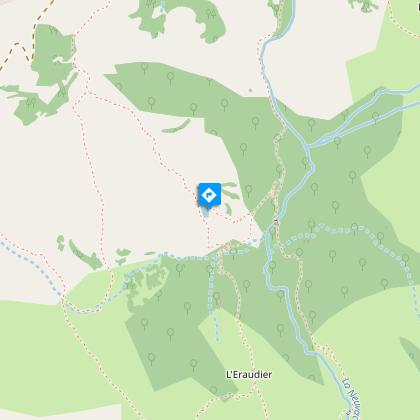
At Cotérieux (sign), turn left onto the path that goes up to Combe Orsière and then down to Lac Vert.
Follow the yellow markings down to the sign "Sous le Lac Vert". Continue to the left until you see the sign "La Portête" where you turn right to cross the bridge over the Neuvache.
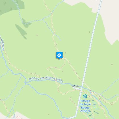
Go up the path on the right bank of the Neuvache. Further up, take the footbridge over the Ruisseau des Grandes Culées to reach the Refuge de Terre Rouge.
---
RETURN
At the sign "Refuge de Terre Rouge", follow the direction of the Chenalette to cross the two streams on footbridges (be careful: do not trust the sign "Notre Dame des Neiges" which does not indicate the right direction).
The path climbs a little to reach the Notre Dame des Neiges chapel about a hundred metres away.
Follow the signs for "la Chenalette" to pass the Vallons water intake and find the parking area.
Technical Information
Altimetric profile
Starting point
Steps
Date and time
- From 15/05/2026 to 15/10/2026
- From 15/05/2027 to 15/10/2027
Additional information
Environments
Lakeside or by stretch of water
Lake view
Mountain view
Mountain location
Waterside
Updated by
Office de Tourisme de Valmeinier - 13/03/2026
www.valmeinier.com/
Report a problem
Open period
From 15/05 to 15/10 daily.
Subject to favorable weather.
Contact
Phone : 04 79 59 53 69
Email : info@valmeinier.com
Website : https://www.valmeinier.com/
Facebook : https://www.facebook.com/valmeinierofficiel
Location complements
From Valmeinier, go up towards Valmeinier 1800 and after the 5th hairpin turn right.
It continues on a track which ends at the Chenalette car park.
