Alert
Alerts
Tour du Villaret via the Pissieu waterfall


IGN cards


Description
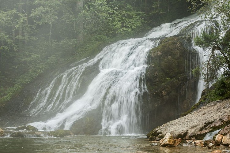
Introduce your children to a geosite? In other words, get your feet wet at the Pissieu waterfall! It's a great way to learn while having fun, and enjoy the coolness of the site...
At the start, we calmly take the wide track on the edge of the forest, accompanied by the song of the brook.
After a while, we hear a noise. It's just a dull rumble in the distance. Growing louder.
Then it's the fresh spray on our faces that lets us know it's just around the corner. And there it is, the cascade du Pissieu!
All the water from the Margeriaz plateau rushes here through a gigantic underground network (79km known, including the tanne du Cochon, which descends 825 metres into the mountain!) and rushes over the rocks, precipitating the droplets into a cold, noisy cloud.
A refreshing sight, especially on a day after heavy rain. What fun it is to get as close to the waterfall as possible, hopping from rock to rock.
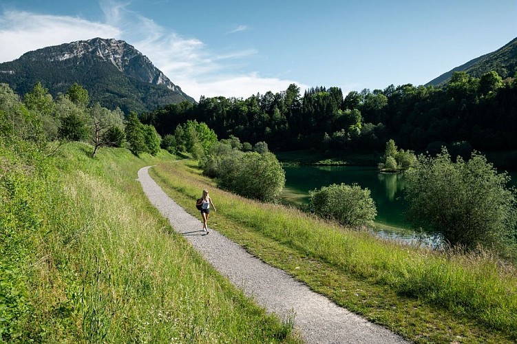
As you gain height, the route invites you under the protective shade of the trees. Alternating between balconies, it offers beautiful views of the surrounding mountains.
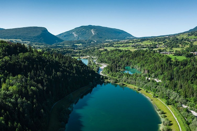
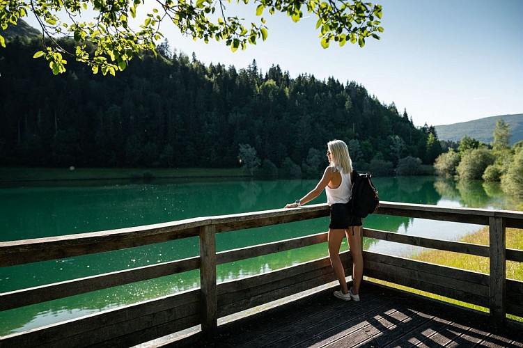
The return journey is also cool, to the Châtelard lake. Why not finish the hike with a dip?
Technical Information
Altimetric profile
Starting point
Points of interest


Additional information
Updated by
Grand Chambéry Alpes Tourisme - 17/11/2025
www.chamberymontagnes.com
Report a problem
Environments
Forest location
In the country
Lake 5 km away
Location complements
In the heart of the Bauges, reach the village of Lescheraines and head for Aillon-le-Jeune (D59). After 2km, at the villaret Rouge hamlet, turn left towards La cascade du Pissieu, then left again 500m further on towards the Châtelard parking lot.
Tips
.
Type of land
Ground
Grit
Not suitable for strollers
Contact
Phone : 04 79 54 84 28
Email : accueil.bauges@chamberymontagnes.com
Website : https://www.chamberymontagnes.com
Guidebook with maps/step-by-step
Start: from the Châtelard parking lot, head for the totem pole indicating the "Cascade du Pissieu" / possibility of accessing the route from the Plan d'eau de Lescheraines (dotted line).
1/ Take the wide path at the edge of the forest. Pass the old swift (Chèvrerie), then go straight on to the Tournebroche crossroads.
2/ At Tournebroche, turn left towards the waterfall, which is about 5 minutes away (you can also visit the spring, about 100 m above the waterfall). Retrace your steps to reach the crossroads, then turn left towards Le Villaret - Rossillon. The path climbs steadily up to the main road.
3/ At the road, cross over and take the path leading off to the right. Follow this path for several hundred metres, following the PR signs (yellow).
4/ At the next crossroads, turn left towards Le Rossillon.
5/ At Rossillon, turn right. Cross back over the departmental road, where the next part of the path is opposite. Continue downhill through the woods.
6/ At the bottom, turn right on the GR to reach the Châtelard lake. You are free to choose whether to return to the Châtelard parking lot by the right or left bank, crossing the gravel pit platform and taking one end of the road, then turning left to return to the parking lot.
Animals
Yes
Data author
