Alert

Alerts

To see around
See more
Open
Close
Show
Show
Show
Show
Show
Show
Show
Show
Show
Show
Show

Oups... It would appear that Cirkwi does not have permission to use your location.

Presentation
Description
Map
Points of interest
Ratings and reviews
See around

Randonnée - la chapelle sainte sabine

Randonnée - la chapelle sainte sabine
Credit : OTRP

IGN cards

3518OT - ÉPINAL BRUYÈRES VALLÉE DE LA MOSELLE
Editor : IGN
Collection : TOP 25 ET SÉRIE BLEUE
Scale : 1:25 000
13.90€
3519OT - REMIREMONT LE VAL-D'AJOL PLOMBIÈRES-LES-BAINS
Editor : IGN
Collection : TOP 25 ET SÉRIE BLEUE
Scale : 1:25 000
13.90€
TOP75028 - VOSGES DU SUD BALLON D'ALSACE LE HOHNECK
Editor : IGN
Collection : TOP 75
Scale : 1:75 000
9.80€
TOP100D68 - HAUT-RHIN TERRITOIRE DE BELFORT COLMAR MULHOUSE BELFORT PNR DES BALLONS DES VOSGES
Editor : IGN
Collection : TOP 100
Scale : 1:100 000
8.40€
TOP100D70 - HAUTE-SAÔNE VESOUL LURE VALLÉE DE LA SAÔNE
Editor : IGN
Collection : TOP 100
Scale : 1:100 000
8.40€
130 VESOUL LANGRES VALLÉE DE LA SAÔNE
Editor : IGN
Collection : TOP 100
Scale : 1:100 000
8.40€
TOP100D88 - VOSGES ÉPINAL NEUFCHÂTEAU ST-DIÉ-DES-VOSGES GÉRARDMER PNR DES BALLONS DES VOSGES
Editor : IGN
Collection : TOP 100
Scale : 1:100 000
8.40€
121 NANCY ÉPINAL VALLÉE DE LA MOSELLE
Editor : IGN
Collection : TOP 100
Scale : 1:100 000
8.40€
201 ALSACE MASSIF DES VOSGES
Editor : IGN
Collection : TOP 200
Scale : 1:200 000
6.80€
D70-88-90 HAUTE-SAÔNE VOSGES TERRITOIRE DE BELFORT
Editor : IGN
Collection : CARTES DÉPARTEMENTALES IGN
Scale : 1:150 000
5.90€
D67-68 BAS-RHIN HAUT-RHIN
Editor : IGN
Collection : CARTES DÉPARTEMENTALES IGN
Scale : 1:150 000
5.90€
NR09 BOURGOGNE FRANCHE-COMTÉ
Editor : IGN
Collection : CARTES RÉGIONALES IGN
Scale : 1:250 000
6.80€
EUROPE
Editor : IGN
Collection : DÉCOUVERTE DES PAYS DU MONDE IGN
Scale : 1:2 500 000
7.00€
ALLEMAGNE
Editor : IGN
Collection : DÉCOUVERTE DES PAYS DU MONDE IGN
Scale : 1:800 000
7.00€

Description

Access: From St-Etienne-lès-Remiremont, at the roundabout in the centre, towards the mobile police station. Continue to climb towards the Domaine Saint-Romary. After the domain, stay on the road until the next crossing on the right with a dirt road.
Parking: Park 100m further on at the hiking sign.

Distance: 7 km / Duration: 2 h 30 / Difference in height: 350m / Signs: red ring to the Hermitage Saint Arnould then yellow ring.

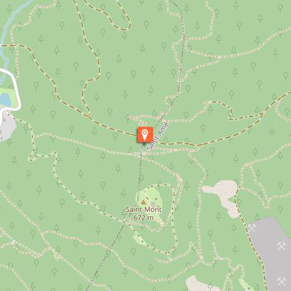
On the carriage road, park at a crossroads with hiking trails. From there, follow the red ring signposting by turning right towards the Pont des fées to reach it.
Just before the Pont des fées, take the Sentier des Moines on the left which climbs for a while. Follow the signs until you reach the Ermitage Saint Arnould. Take the time to admire a nice view of Saint-Etienne les Remiremont shortly before arriving there.
On the spot at the Saint Arnould hermitage: small viewpoint, engraved rock, remains and archaeological excavations. This is the moment when the signposting changes. From now on, take the yellow ring signposting which leaves on a path on the right after the Saint Arnould cross. Follow this signposting which will change from a path to a track to reach the Kerlinquin stone (745m altitude). At the crossroads, turn left, then 50m further on take the leftmost path. Keep to the signs and take the path that will lead you to the Sainte-Sabine chapel. On site: chapel and fountain.
To leave the site, go behind the chapel and then go up on the left to take the path, which is always marked with a yellow ring. Further up, at the crossroads at the level of a large cross, take the road which descends on the left. Follow this path and the yellow ring markings for more than a kilometre.
Leave the road and take a marked path to the right. Be careful, the descent to the starting point is a bit steep: take your time!

Technical Information

Walking
Difficulty
Hard
Duration
2h30mn
Dist.
6.7 km
Show more

Altimetric profile

Starting point

Saint-Romary Chemin carrossable à droite de rue "Saint-Romary" , 88200   SAINT ETIENNE LES REMIREMONT
Lat : 48.028038759285Lng : 6.6247742526398

Points of interest

Additional information

Producteur de la donnée

Ces informations sont issues de la plateforme SITLOR - Système d’Information Touristique - Lorraine
Elles sont synchronisées dans le cadre du partenariat entre Cirkwi, l’Agence régionale du Tourisme Grand Est et les membres du comité technique de Sitlor.

Contact

Tel : 03 29 62 23 70
Email : remiremont@otrp.fr
Site web : www.tourisme-remiremont-plombieres.com

Data author

Ratings and reviews

To see around
See more
Open
Close
Show
Show
Show
Show
Show
Show
Show
Show
Show
Show
Show
Caution!
We have no information on the difficulty of this circuit. You may encounter some surprises along the way. Before you go, please feel free to inquire more and take all necessary precautions. Have a good trip! 🌳🥾