Alert
Alerts
Hike: Le Mont-Charvin


IGN cards


Description
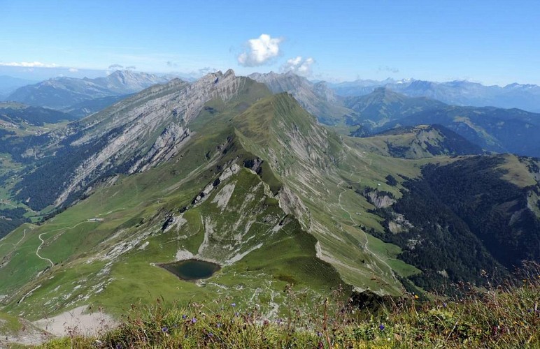
A slight vertignous hike with a spectacular view of the Aravis Valleys and Mont-Blanc Beaufortain, and the Bauges mountain ranges.
Technical Information
Altimetric profile
Starting point
Points of interest
Additional information
Contact
Phone : 04 50 44 60 24
Email : accueil@sources-lac-annecy.com
Facebook : https://www.facebook.com/sources.lac.annecy.tourisme/
Google+ : https://plus.google.com/u/0/111088530102805483892
Open period
All year round.
Environments
Lakeside or by stretch of water
Mountain view
Waterside
Mountain location
Type of land
Not suitable for strollers
Topo guides and map references
Topo guides references :
Map available at the tourist office.
Updated by
Office de Tourisme des Sources du Lac d'Annecy - 15/09/2025
www.sources-lac-annecy.com
Report a problem
Tricky passages
This hike is not recommended in wet weather because some parts can be slippery and a fall would be fatal.
Guidebook with maps/step-by-step
1/ From the Sardoches carpark, follow the signs to the Chalet des Praz and then to the Aulp de Marlens.
2/ Continue the ascent towards the Mont-Charvin summit via Pied de la Combe.
3/ From there, hike up the Combe du Charvin, follow the path across the screes and to the ridge in large zigzags.
4/ Hike up along the ridge to the top of the Mont Charvin.
5/ Get back to Les Sardoches parking via the same itinerary.
Animals
Yes


