Alert
Alerts
Type of practice
Mountainbiking
Hard
10mn
Presentation
Description
Map
Points of interest
Ratings and reviews
See around
"La Vosgienne" : La Vosgienne downhill mountain bike track in Ucimont


Credit : O Beart Vojo
IGN cards

3009SB - CHARLEVILLE-MÉZIÈRES SEDAN
Editor : IGN
Collection : TOP 25 ET SÉRIE BLEUE
Scale : 1:25 000
13.90€

105 CHARLEVILLE-MÉZIÈRES VERDUN FÔRET DES ARDENNES VALLÉE DE LA MEUSE
Editor : IGN
Collection : TOP 100
Scale : 1:100 000
8.40€

D02-08 AISNE ARDENNES
Editor : IGN
Collection : CARTES DÉPARTEMENTALES IGN
Scale : 1:150 000
5.90€

PAYS-BAS BELGIQUE LUXEMBOURG
Editor : IGN
Collection : DÉCOUVERTE DES PAYS DU MONDE IGN
Scale : 1:300 000
7.00€

EUROPE
Editor : IGN
Collection : DÉCOUVERTE DES PAYS DU MONDE IGN
Scale : 1:2 500 000
7.00€
Description
A downhill mountain bike trail accessible to a more experienced public; requiring technique and specific riding equipment.
Difficulty: black, expert level.
The "Vosgienne" trail covers 1200m of downhill for enduro mountain bikes in the Virée des Frétis forest and the Liresse valley.
This is a dirt forest trail, mainly through coniferous stands, with magnificent valley bottoms.
Technical Information
Mountainbiking
Difficulty
Hard
Duration
10mn
Dist.
1.2 km
Type of practice
Mountainbiking
Hard
10mn
Show more
Altimetric profile
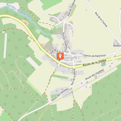
Starting point
Chemin des Foutraits
,
6833
Ucimont
Lat : 49.83989Lng : 5.02689
Points of interest
Additional information
Signalétique (EN)
N3-EN (Enduro) - Expert
Data author

proposed by
Pays de Bouillon en Ardenne
Ratings and reviews
To see around