Alert
Alerts
Cycling route: Col de Merdassier
Description
This ride is a slightly longer version of the Col de la Croix-Fry climb. However, it is on the beautiful, south-facing bends of the Croix-Fry that you will find the steepest gradients and an unbeatable view of the Tournette.
Technical Information
Altimetric profile
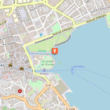
Starting point
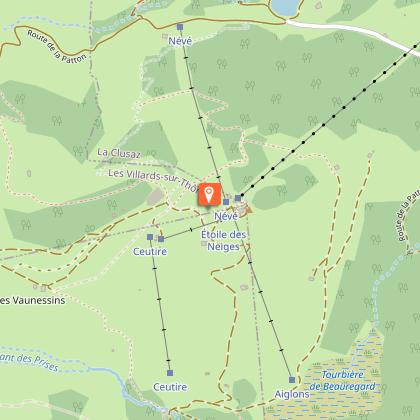
Points of interest

Date and time
- From 01/04/2026 to 31/10/2026
- From 01/04/2027 to 31/10/2027
Additional information
Updated by
Conseil Départemental de la Haute-Savoie - 08/07/2026
hautesavoiemontblanc-tourisme.com/
Report a problem
Open period
From 01/04 to 31/10.
Contact
Phone : 04 50 45 00 33
Email : info@lac-annecy.com
Website :
https://www.lac-annecy.com
https://hautesavoiemontblanc-tourisme.com/
Facebook : https://www.facebook.com/lacannecy.tourisme
Location complements
From Annecy: east side of the lake, D909. Freeway: A41 exit 16 Annecy sud. Railway station: Annecy.
Data author
