Alert
Alerts
18 - LE GENÉVRIER THURIFÈRE
Description
Come and discover an unusual tree. The mountain of Rié is home to one of the first trees to appear in the Pyrenees after the ice age 14,000 years ago: the thurifer juniper.
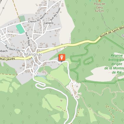
Start at the top of the village of Marignac and head to the Saint-Martin chapel. Then climb up the wagon track to complete the Thuriferous Juniper Trail loop. It runs through the Rié mountain with beautiful views and takes you back to the hamlet of Saint-Martin through the chestnut grove.
Technical Information
Altimetric profile
Starting point
Additional information
Detailed stages
1 - From the Place des Évadés (altitude 526 m), descend towards the village and take the street on the right (signposted ""sentiers"").
4 - Climb the steep path called ""la travée de descente des wagonnets"" until you reach the sign (altitude 630 m). Continue straight ahead, climbing this yellow-marked trail. You will come to a fork (altitude 850 m) with a sign for ""Sentier du Thurifère 2h"" on the left and ""Marignac 1h"" on the right.
5 - Follow the Thurifer's Path and you will find a juniper tree and a beech tree marked with yellow signs.
2 - You will arrive at the ""Saint-Roch"" signpost (altitude 522 m), turn right. Climb up the stony path that runs alongside a property. You will arrive at a small chapel and a picnic table. Follow the path in front of you to reach the Saint-Martin chapel (signpost - altitude 588 m) and a few houses.
6 - The path climbs through a rockier, more Mediterranean landscape, offering beautiful views of the valley.
3 - Turn left and walk past the picnic table to reach the ""Quai de chargement"" signpost (altitude 588 m).
7 - You will arrive at a fork indicating the marble quarries. Stay on the path clearly marked in yellow. Begin the descent with a steep section.
8 - You will return to the initial fork (altitude 850 m). Take the path to the left marked ""Marignac - 1 hour"".
9 - The trail passes through a beech forest. Descend the steps and follow the track downhill.
10 - At the point marked 692m, take the path downhill on your right (signposted ""Marignac - 30 minutes""). This path is a little steep and descends to the houses of the hamlet of Saint-Martin, just opposite the chapel.
11 - Take the path downhill towards Marignac, and after 10 minutes you will return to the Place des Évadés.
Dates
From 2026-04-01T00:00:00 From 2026-11-30T00:00:00
Elevation gain
520 (Medium)
Start and end town
MARIGNAC
Contact
Tel : 05 61 79 21 21
Email : info@pyrenees31.com
Website : www.pyrenees31.com
Data producer
Contact : HAUTE-GARONNE TOURISME / OFFICE DE TOURISME PYRÉNÉES 31
Phone : 05 61 79 21 21
This information comes from the Haute-Garonne Departmental Tourism Network and is synchronized as part of the partnership between Cirkwi and Haute-Garonne Tourisme.
Data author
