Alert
Alerts
Randonnée - le chemins des pierres

Description
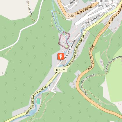
Access: From Remiremont, go to Plombières-les-Bains. Cross the town then take the Casino direction.
Parking: Park opposite the Parc Impérial.
Distance: 9 km / Duration: 3 h / Difference in height: 170m / Marking: green disc.
1) Leave the Parc Impérial and walk around the outdoor swimming pool to the left. Cross the old railway bridge over the Augronne. Walk about 500m on the old ballast.
2) Leave the ballast for a tarmac path, then a second path, only gravelled, going to the right. In its first part, it follows the contour line. As the path widens and rises, keep the same course.
3) A sign indicates the Pierre Rousseau situated slightly below the path (text engraved in the stone borrowed from Rousseau). Continue straight on to the Moulin Taqueré (remains of the last mill near the stream).
stream).
4) Retrace your steps to the farm, walk along the edge of the forest in search of the Red Cross (on the base: the names of the three young men who were massacred in this forest). At the next crossroads, a short signposted track leads to the cup stone, 300m round trip. Continue upstream on a wide forest track leading to the hamlet of Petit Moulin.
5) Cross this hamlet then the D 157 and go straight into the small wood. At the end of the wood, a tarmac track leads from farm to farm. At the second crossroads, turn left towards the gas station.
6) Meet the fountain circuit. Follow the left-hand path towards a last farm and its calvary. Go down to the forest and follow the small path on the right.
7) The end of the circuit, all downhill, leads back to the imperial park by the main street of the station or by the discovery circuit of Plombières and the Tivoli park.
Technical Information
Altimetric profile
Starting point
Points of interest


Additional information
Producteur de la donnée
Ces informations sont issues de la plateforme SITLOR - Système d’Information Touristique - Lorraine
Elles sont synchronisées dans le cadre du partenariat entre Cirkwi, l’Agence régionale du Tourisme Grand Est et les membres du comité technique de Sitlor.
Contact
Tel : 03 29 66 01 30
Email : plombieres@otrp.fr
Data author
