Alert
Alerts
Randonnée - cascade de miraumont par la piotte

Description
Access : Departure from the centre of Saint-Etienne-lès-Remiremont
Parking: Church car park
Distance: 4.6 km / Duration: 1 h 30 / Difference in height: 165 m / Marking: green ring
1) From the church, take the sports trail (between the stadium and the collective housing). Cross the small bridge, continue along the path and before the wooden bridge, take the small road on the right, between the houses (chemin de la Moutière).
2) Before the green house, go up a steep path on the right which joins a small road (on the right) and then a stony path. Leave the path at the first bend to take the path opposite which climbs towards the Xennois pond.
3) From the pond, go back down the main path and continue up to a small road (small private chapel). Continue along the road and then fork at the junction downhill and around a pond. At the next junction, descend to the hostel and the Chapelle Sainte Claire.
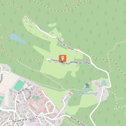
4) At the back of the hostel (go round to the right), go down into the forest to the Cascade de Miraumont.
5) Continue downhill, exit the forest (small bridge), continue on the road (mobile police station), and turn right (rue de Deal) to reach the car park (cave).
Technical Information
Altimetric profile
Starting point
Points of interest

Additional information
Producteur de la donnée
Ces informations sont issues de la plateforme SITLOR - Système d’Information Touristique - Lorraine
Elles sont synchronisées dans le cadre du partenariat entre Cirkwi, l’Agence régionale du Tourisme Grand Est et les membres du comité technique de Sitlor.
Contact
Tel : 03 29 62 23 70
Email : remiremont@otrp.fr
Site web : www.tourisme-remiremont-plombieres.com/
Data author
