Alert
Alerts
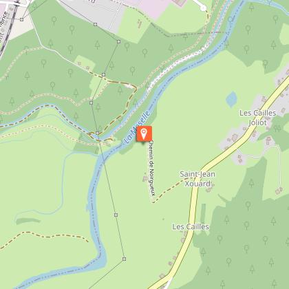
Randonnée - la stèle de Noirgueux


IGN cards


Description
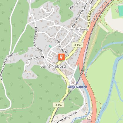
Access: From Remiremont, towards Saint-Nabord via Ranfaing.
Parking: Car park of the socio-cultural centre.
Distance: 11.2 km / Duration: 2 h 45 / Difference in height: 100 m / Signs: Blue disc.
From the car park of the Saint-Nabord socio-cultural centre, walk towards the level crossing along the cemetery. Go past the camper van park and 100m further on take the road "à la côte" on the left. Follow the road and the blue disc markings. Pass under the bridge of the motorway and then turn left immediately.
When you reach the canal exit, start walking along it on the right. Turn right at the first bridge after a few metres onto a path that leads into the fields. Follow the blue disc marking, first on a path, then on a carriageway which runs alongside the ponds to arrive at an earthen car park at the Vouau ponds. Cross the car park going straight ahead.
At the end of the car park, turn left onto the road that goes up. Go towards the bridge and turn right just before it, always following the blue disc marking. Stay on the path that runs alongside the canal. At the next bridge, cross the road to continue on the path along the canal. On this path, you can see signs for the "Moraine Trail" (educational sign: the grassland, Natura 2000 area).
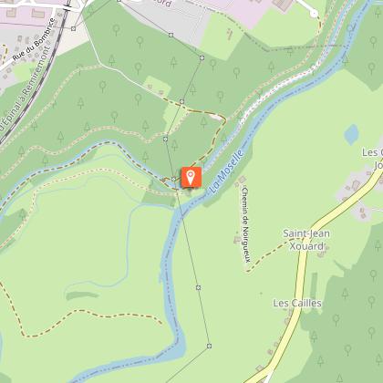
The path joins a carriage road near another bridge, continue straight on to reach the stele and moraine of Noirgueux (educational panel: le Tracé de la Moselle).
After Noirgueux, continue on the path that runs alongside the canal and leads to a lock. Here the canal becomes underground. Continue on the path above the bridge, still marked with a blue disc. At the next intersection, at the educational sign "canal d'alimentation de Bouzey", take the path on the left following the sign "sentier moraine". At the end of the path turn left uphill. Continue until you reach a car park.
At the car park, take the road for a short while. After 500m, leave the road for a path on the left just before a gas station. A little further on, again an educational panel ("le site de Noirgueux"). Pass the hills and a new sign ("hommage à Henri Hogard").
At the end of the path, take the carriage road straight ahead. 50m further on, walk along a stone arch bridge, staying on the path which turns slightly to the left. Stay on this path which will then join the road, turn left and then right to pass the barrier of the Perrey stadium. After the barrier, turn immediately right onto a road which climbs up and runs alongside the dual carriageway and railway.
At the crossroads at the end of the stadium, go straight ahead on the path which still runs along the railway line and ends with a fairly steep descent. Return to the beginning of the canal. Turn right to return to the starting point by the same road as on the way out.
Technical Information
Altimetric profile
Starting point
Points of interest
Additional information
Producteur de la donnée
Ces informations sont issues de la plateforme SITLOR - Système d’Information Touristique - Lorraine
Elles sont synchronisées dans le cadre du partenariat entre Cirkwi, l’Agence régionale du Tourisme Grand Est et les membres du comité technique de Sitlor.
Contact
Tel : 03 29 62 23 70
Email : remiremont@otrp.fr
Data author
